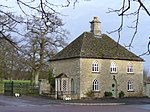
Quenington

Quenington is a nucleated village and larger rural civil parish in the Cotswold district of Gloucestershire, England, on the River Coln 8 miles (13 km) east of Cirencester and 2 miles (3.2 km) north of Fairford. It has a recorded population of 603 people as at the 2011 census.Important historic buildings include a medieval large dovecote above a gatehouse, and St Swithin's Church of England parish church, built mainly in the late 11th century and (despite partial Victorian restoration) listed in the highest category of listed building, Grade I. The village has a village hall, a pub and a village green. Its economy has been transformed to render agriculture a minor but physically evident employer across most of the area: this area of the Cotswolds has been almost wholly been turned over from forest to agriculture, landscape parks and private or semi-private gardens. The working population divides includes mainly short-distance commuters and remote workers. A significant minority work in the district's leisure, food and hospitality sector. The Cotswold Water Park lies to the south and the Cotswold scarp is away to the north and west.
Excerpt from the Wikipedia article Quenington (License: CC BY-SA 3.0, Authors, Images).Quenington
The Green, Cotswold District Quenington
Geographical coordinates (GPS) Address Nearby Places Show on map
Geographical coordinates (GPS)
| Latitude | Longitude |
|---|---|
| N 51.736 ° | E -1.792 ° |
Address
The Green
The Green
GL7 5BS Cotswold District, Quenington
England, United Kingdom
Open on Google Maps


