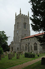
Ovington, Norfolk
Breckland DistrictCivil parishes in NorfolkVillages in Norfolk

Ovington is a civil parish in the English county of Norfolk. It covers an area of 6.44 km2 (2.49 sq mi) and had a population of 239 in 92 households at the 2001 census, increasing to a population of 256 in 101 households at the 2011 Census. It is in the district of Breckland. Ovington is represented by the Saham Toney ward of Breckland District Council and the Watton Division of Norfolk County Council.
Excerpt from the Wikipedia article Ovington, Norfolk (License: CC BY-SA 3.0, Authors, Images).Ovington, Norfolk
Church Road, Breckland District
Geographical coordinates (GPS) Address Nearby Places Show on map
Geographical coordinates (GPS)
| Latitude | Longitude |
|---|---|
| N 52.58621 ° | E 0.84011 ° |
Address
Church Road
IP25 6RY Breckland District
England, United Kingdom
Open on Google Maps


