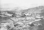
New Washoe City, Nevada
New Washoe City is an unincorporated community located in Washoe County, Nevada, United States. It is located in the Washoe Valley in southern Washoe County between Reno and Carson City, on the east side of Washoe Lake. It is part of the Reno–Sparks Metropolitan Statistical Area. As of the 1990 census, New Washoe City had a population of 2,875. The area was not listed as a census-designated place (CDP) at the 2000 census but was listed as "Washoe Valley, Nevada", for the 2010 census, at which time it had a population of 3,019.New Washoe City was founded as a planned community in 1961. Lots were on sale for $1500 then, $35 down and $35 per month.New Washoe City is named after the older, much smaller nearby locale of Washoe City, commonly referred to as Old Washoe City, which clusters around the northwest side of Little Washoe Lake. New Washoe City is probably best known for its nearby proximity to Washoe Lake, Little Washoe Lake and the adjacent Washoe Lake State Park. New Washoe City is connected to the Reno-Carson City corridor, US 395/I-580 and U.S. Route 395 Alternate by Eastlake Boulevard (former State Route 428). Washoe City, founded in August 1861, was the first county seat of Washoe County. The county seat moved to Reno in February 1871.New Washoe City's ZIP code is 89704 and is associated with the Washoe Valley. The town is commonly also associated with Carson City, even though it is entirely within Washoe County borders.
Excerpt from the Wikipedia article New Washoe City, Nevada (License: CC BY-SA 3.0, Authors).New Washoe City, Nevada
Chipmunk Drive, Washoe Valley CCD
Geographical coordinates (GPS) Address Nearby Places Show on map
Geographical coordinates (GPS)
| Latitude | Longitude |
|---|---|
| N 39.301388888889 ° | E -119.77166666667 ° |
Address
Chipmunk Drive 2261
89704 Washoe Valley CCD
Nevada, United States
Open on Google Maps


