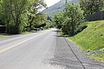
Mayer State Park
Columbia River GorgeHistoric Columbia River HighwayOregon geography stubsParks in Wasco County, OregonState parks of Oregon ... and 1 more
Use mdy dates from August 2023

Mayer State Park is a state park in the Columbia River Gorge, near Rowena, Oregon in Wasco County in the U.S. state of Oregon. It consists of several disjointed parcels of transected by Interstate 84 and the tracks of the Union Pacific Railroad. The south-easternmost parcel includes the Rowena Loops, a series of horseshoe curves by which the Historic Columbia River Highway (U.S. Route 30) climbs to the Rowena Crest, where there is an overlook, from the community of Rowena.
Excerpt from the Wikipedia article Mayer State Park (License: CC BY-SA 3.0, Authors, Images).Mayer State Park
Rowena River Road,
Geographical coordinates (GPS) Address Nearby Places Show on map
Geographical coordinates (GPS)
| Latitude | Longitude |
|---|---|
| N 45.675676 ° | E -121.2697945 ° |
Address
Rowena River Road 5954
97058
Oregon, United States
Open on Google Maps


