place

Grosses Fiescherhorn

Alpine four-thousandersBernese AlpsBern–Valais borderFour-thousanders of SwitzerlandMountains of Switzerland
Mountains of ValaisMountains of the AlpsMountains of the canton of Bern
Gross Fiescherhorn
Gross Fiescherhorn

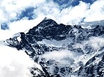
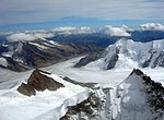
Grosses Fiescherhorn is a mountain peak of the Bernese Alps, located on the border between the cantons of Bern and ValaisValais, halfway between the Mönch and the Finsteraarhorn. At 4,049 metres (13,284 ft) above sea level, its summit culminates over the whole Fiescherhorn massif (German: Fiescherhörner), which is also composed of the slightly lower Hinteres Fiescherhorn (4,025 m (13,205 ft)) to the south and Kleines Fiescherhorn (also called Ochs aka ox, 3,895 m (12,779 ft)) to the east. From the north both are well hidden behind other mountain peaks and can only been seen from Isch in Grindelwald (1,095 m). The mountain is shared between the municipalities of Grindelwald and Fieschertal. Ascents are usually made from one of these three popular routes: one starts from the Mönchsjoch Hut, one from the Konkordia Hut, and the third from the Finsteraarhorn Hut.

Excerpt from the Wikipedia article Grosses Fiescherhorn (License: CC BY-SA 3.0, Authors, Images).

Geographical coordinates (GPS)

Latitude Longitude
N 46.551388888889 ° E 8.0611111111111 °
placeShow on map

Address

Fieschertal


Wallis, Switzerland
mapOpen on Google Maps

Website
fieschertal.ch

linkVisit website

Gross Fiescherhorn
Gross Fiescherhorn
Share experience

Nearby Places

Lower Grindelwald Glacier

The Lower Grindelwald Glacier (German: Unterer Grindelwaldgletscher) is a Glacier in the Swiss Bernese Alps, situated to the south-east of Grindelwald. It starts below the Agassizhorn and the Strahlegghörner and is connected with the Finsteraar Glacier via the Finsteraarjoch (3,390 m (11,120 ft)). The Lower Grindelwald Glacier yet has a major tributary, the Ischmeer (Swiss German for Ice Sea, formerly known as Grindelwald-Fiescher Glacier, German: Grindelwald-Fieschergletscher), which is the glacier overlooked by the Jungfrau Railway's Eismeer railway station. The Lower Grindelwald Glacier was about 8.3 kilometres (5.2 mi) long and covered an area of 20.8 km2 (8.0 sq mi) in 1973. The glacier has significantly shrunk since, having a length of just 6.2 kilometres (3.9 mi) in 2015, with most of the retreat (1.9 km (1.2 mi)) happening since 2007.In the middle of the 19th century it clearly reached into the valley of Grindelwald as far as Mettenberg at an altitude of 983 m (3,225 ft), an eastern quarter of Grindelwald, near the conjunction of the Schwarze and Weisse Lütschine In 1900, it still reached as far as Rote Fluh (1,200 m (3,900 ft)) and filled the entire valley of its current end, the glacier lake, with a thickness of about 300 metres (980 ft) up to an altitude of 1,700 metres (5,600 ft), just below the current hiking path around the Bänisegg. Around 2000 it still reached into the gorge between the Hörnli (Eiger) and Mättenberg. The Lower Grindelwald Glacier should not be confused with the Upper Grindelwald Glacier, situated to its north-east. The Grindelwald-Fiescher Glacier should not be confused with the like-named Fiescher Glacier, to the south of the Fiescherhorn.