place

Kharkov Governorate

1780 establishments in the Russian EmpireGovernorates of UkraineGovernorates of the Russian EmpireHistory of Kharkiv OblastKharkov Governorate
Russian history stubsStates and territories disestablished in 1918States and territories disestablished in 1925States and territories established in 1780States and territories established in 1835Ukrainian history stubs
Kharkov guberniya
Kharkov guberniya

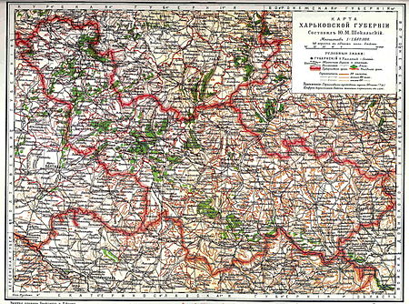
The Kharkov Governorate (Pre-reformed Russian: Ха́рьковъская губе́рнія, tr. Khar'kovskaya guberniya, IPA: [ˈxarʲkəfskəjə ɡʊˈbʲernʲɪjə]; Ukrainian: Харківська губернія, romanized: Kharkivska huberniia) was a governorate of the Russian Empire founded in 1835. It embraced the historical region of Sloboda Ukraine. From 1765 to 1780 and from 1796 to 1835 the governorate was called the Sloboda Ukraine Governorate. In 1780-1796 there existed the Kharkov Viceroyalty. From 1765 to 1780, the Sloboda–Ukraine Governorate existed. In 1780, the Kharkov Viceroyalty was established and lasted until 1796. In 1835, the Viceroyalty was again reorganized into the Sloboda-Ukrainian Governorate, and from 1835 onwards, the Kharkov Governorate was formed, which existed until 1925. With each reorganization, the boundaries and administrative structure change significantly. The main state tax implementation, processing, and publishing of statistical information for the Kharkov governorate were the Kharkov Governorate Statistical Committee.

Excerpt from the Wikipedia article Kharkov Governorate (License: CC BY-SA 3.0, Authors, Images).

Kharkov Governorate
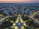
Дубова алея, Kharkiv Derzhprom

Geographical coordinates (GPS) Address Nearby Places
placeShow on map

Wikipedia: Kharkov GovernorateContinue reading on Wikipedia

Geographical coordinates (GPS)

Latitude Longitude
N 50 ° E 36.2292 °
placeShow on map

Address

Скульптура «Ваш портрет пензля Іллі Рєпіна»

Дубова алея
61057 Kharkiv, Derzhprom
Kharkiv Oblast, Ukraine
mapOpen on Google Maps

Kharkov guberniya
Kharkov guberniya
Share experience

Nearby Places

Istorychnyi Muzei (Kharkiv Metro)

The Istorychnyi Myzei (Ukrainian: Історичний музей, (listen); literally "Historic Museum") is a station on Kharkiv Metro's Saltivska Line. The station was opened on 10 August 1984 and is currently the southwesternmost terminus of the Saltivska Line. It is located beneath the Maidan Konstytutsii, literally Constitution square in the historical part of Kharkiv, and is named for the historical museum which is located on the square. The station, inspired by the history of Kharkiv, has shaped columns and a relief-type ceiling in the station vestibule which give the feeling of the protected fort, which stood at this location during the 17th and 18th centuries. Also, the arrow-shaped arcs between the columns are reminiscent of fort gates. The columns are finished in a light colored marble Koelga and the tunnel walls are finished with brown marble and heraldic items made from bronze, which provide contrast. The Istorychniy Muzei station is located deep underground and is a pylon trivault and was designed by V.A. Spivachuk, P.G. Chechalnitskiy, and I.T. Karpenko; engineered by P.D. Pashkov, V.D. Shtuchkin, and L.P. Hryshyna; and was decorated by P.D. Chernova, V.E. Hutnik; I.I. Morgunov, O.Y. Erofeeva, V.V. Chursin, and V.D.Semenyuk. Istorychniy Muzei forms a complex with the adjacent Maidan Konstytutsii station on the Kholodnohirsko-Zavodska Line. Transfer tunnels from one station to another are located in the centre of the station. Also, four escalators lead into a spacious underground vestibule which is located under the Constitution Square. The vestibule is connected with the underground passenger tunnel which leads onto the square, to the Sums`ka Street, the largest street in Kharkiv, to the Universytets`ka Street, and to the Bursatskyi Descent. In 1985, during the finishing of the transfer tunnel from the Istorychniy Muzei to the Ploshcha Konstytutsii station, a closed-circuit television (CCTV) system was installed, the first in the Kharkiv Metro. Currently, all stations on the system have CCTV. The installation of this system allowed the workers of the metro to keep passengers in order and maintain more effective control over the escalators.

Universytet (Kharkiv Metro)

The Universytet (Ukrainian: Університет, (listen), Russian: Университет) is a station on Kharkiv Metro's Saltivska Line. The station was opened on 10 August 1984 and is located beneath the Ploscha Svobody, at the time, the largest square in Europe and the second largest in the world after Tiananmen Square, in the centre of Kharkiv. The station is named after the Kharkiv National University, which is located on top of the square. Up until 1994 the station was called Dzerzhinska according to the name of the square Poloscha Dzerzhinskoho, (Dzherzhinsky square) after the founder of the Soviet Secret Police Felix Dzerzhinsky. It currently forms a complex with the adjacent station Derzhprom on the Oleksiivska Line. The station is located deep underground and is a bi-level pillar-trispan with blank marble columns. The station's service rooms are located on one of the second level balconies, and the other balcony is used as an underground passenger transfer for when there are fairs and concerts on the Ploscha Svobody. The underground transfer was once used for daily passenger usage during the 1980s, but was closed down during the early 1990s. There are six-meter cupolas in diameter, each hanging 12 meters apart and weighing 120 tons, are incorporated into the ceiling, in which the station's chandeliers hang. The station itself is 13 meters in width, due to the transfer point to the Derzhprom station on the Oleksiyivsky Line. The transfer itself was supposed to include escalator access to passengers, but as there was an economic crisis in the country, the escalators were abandoned and replaced with regular stairs. A large portrait of Felix Dzerzhinsky was located on the station which was later removed after the renovation of the station. Station vestibules are located on both ends of the station, which have been linked with a network of underground passenger tunnels which have many small shops.