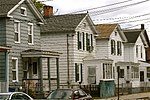
City Point, New Haven
Byzantine Revival architecture in ConnecticutHistoric districts in New Haven, ConnecticutHistoric districts on the National Register of Historic Places in ConnecticutLandforms of New Haven County, ConnecticutNRHP infobox with nocat ... and 4 more
National Register of Historic Places in New Haven, ConnecticutNeighborhoods in New Haven, ConnecticutPeninsulas of ConnecticutTourist attractions in New Haven, Connecticut

City Point (formerly known as Oyster Point) is an area in what is now The Hill neighborhood of the city of New Haven, Connecticut, located in the southwestern portion of the city. The City Point area was, when settled and through the 18th century, a relatively narrow peninsula extending south into New Haven Harbor, located where the West River empties into the harbor. Areas adjacent to the original peninsula have since been filled in, broadening its shoulders, and Interstate 95 has cut across it. The Oyster Point Historic District is a 26-acre (11 ha) historic district encompassing an area of relatively old buildings in City Point south of I-95.
Excerpt from the Wikipedia article City Point, New Haven (License: CC BY-SA 3.0, Authors, Images).City Point, New Haven
Howard Avenue, New Haven
Geographical coordinates (GPS) Address Nearby Places Show on map
Geographical coordinates (GPS)
| Latitude | Longitude |
|---|---|
| N 41.283055555556 ° | E -72.929722222222 ° |
Address
Oyster Point Historic District
Howard Avenue
06519 New Haven
Connecticut, United States
Open on Google Maps


