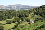
Ceredigion (Welsh pronunciation: [kɛrɛˈdɪɡjɔn]), historically Cardiganshire (), is a county in the west of Wales. It borders Gwynedd across the Dyfi estuary to the north, Powys to the east, Carmarthenshire and Pembrokeshire to the south, and the Irish Sea to the west. Aberystwyth is the largest settlement and, together with Aberaeron, is an administrative centre of Ceredigion County Council.
The county is the second most sparsely populated in Wales, with an area of 688 square miles (1,780 km2) and a population of 71,500; the latter is a decline of 4,492 since the 2011 census. After Aberystwyth (15,935), the largest towns are Cardigan (4,184) and Lampeter (2,970). Ceredigion is considered a centre of Welsh culture and 45.3% of the population could speak the Welsh language at the 2021 census.
To the west, Ceredigion has 50 miles (80 km) of coastline on Cardigan Bay, which is traversed by the Ceredigion Coast Path. Its hinterland is hilly and rises to the Cambrian Mountains in the east, where the highest point is Plynlimon at 752 metres (2,467 ft). The mountains are the source of the county's main rivers: the Rheidol, Ystwyth, Aeron and Teifi; the last of these is Ceredigion's boundary with Carmarthenshire and Pembrokeshire for most of its length.
Ceredigion is named after a minor kingdom which occupied approximately the area of the county in the fifth century AD. The contemporary county has the same borders as Cardiganshire, which was established in 1282 by the English king Edward I after his conquest of Wales. In the 18th and early 19th centuries, the county was more industrialised than it is today; lead, silver and zinc were mined in the area, and Cardigan was the largest port in South Wales. The economy later became highly dependent on dairy farming, but is diversifying into areas such as tourism as farming becomes less profitable. The county is home to the National Library of Wales, Aberystwyth University, and the Lampeter campus of University of Wales Trinity St David.


