place

Hackhurst and White Downs

Hills of SurreyLocal Nature Reserves in SurreyNature Conservation Review sitesSites of Special Scientific Interest in SurreySurrey Wildlife Trust
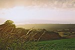
Hackhurst Downs geograph.org.uk 72214

Hackhurst and White Downs is a 185.1-hectare (457-acre) biological Site of Special Scientific Interest west of Dorking in Surrey. White Downs is a Nature Conservation Review site, Grade 2, and part of it is in the 200-hectare (490-acre) White Downs nature reserve, which is owned by the Wotton Estate and managed by the Surrey Wildlife Trust (SWT). Hackhurst Downs is a 29.9-hectare (74-acre) Local Nature Reserve, which part of the 40-hectare (99-acre) Hackhurst Downs nature reserve, which is owned by Surrey County Council and also managed by the SWT.This steeply sloping land is a shared escarpment with Ranmore Common, amounting to an almost whole section of the North Downs, which has grassland, secondary woodland and scrub. It has a rich invertebrate fauna with forty species of butterfly, including adonis blue, chalkhill blue, brown hairstreak, Duke of Burgundy fritillary, marbled white and silver-spotted skipper.

Excerpt from the Wikipedia article Hackhurst and White Downs (License: CC BY-SA 3.0, Authors, Images).

Hackhurst and White Downs
Whitedown Lane, Mole Valley

Geographical coordinates (GPS) Address Nearby Places
placeShow on map

Wikipedia: Hackhurst and White DownsContinue reading on Wikipedia

Geographical coordinates (GPS)

Latitude Longitude
N 51.23 ° E -0.402 °
placeShow on map

Address

Whitedown Lane
RH5 6SN Mole Valley
England, United Kingdom
mapOpen on Google Maps

Hackhurst Downs geograph.org.uk 72214
Share experience

Nearby Places

Surrey Wildlife Trust

Surrey Wildlife Trust (SWT) was founded in 1959 as Surrey Naturalists' Trust and it is one of forty-six wildlife trusts covering Great Britain, Northern Ireland, Isle of Man and Alderney. SWT carries out conservation activities on a considerable area of Surrey County Council's large countryside estate and also manages land on behalf of the Ministry of Defence estate. As of 2022 the SWT manages more than 6,000 hectares (15,000 acres) of land for wildlife and employs more than 100 staff. It had an income of £5.1 million and expenditure of £5.7 million.As of April 2022 the SWT manages sixty-eight nature reserves. Thirty-one are Sites of Special Scientific Interest, nine are Special Protection Areas, eight are Special Areas of Conservation, one is a national nature reserve, twelve are local nature reserves, four are Nature Conservation Review sites, two are Geological Conservation Reviews, five include scheduled monuments and two are listed on the Register of Historic Parks and Gardens of Special Historic Interest. Surrey is a county in South East England. It has an area of 642 square miles (1,660 square kilometres) and an estimated population of 1.19 million as of 2017. It is bordered by Greater London, Kent, East Sussex, West Sussex, Hampshire and Berkshire. Its top level of government is provided by Surrey County Council and the lower level by eleven boroughs and districts, Elmbridge, Epsom and Ewell, Guildford, Mole Valley, Reigate and Banstead, Runnymede, Spelthorne, Surrey Heath, Tandridge, Waverley and Woking.