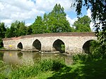
Abinger
Civil parishes in SurreyMole ValleyOpenDomesdayUse British English from June 2016Villages in Surrey

Abinger is a large, well-wooded and mostly rural civil parish that lies between the settlements of Dorking, Shere and Ewhurst in the district of Mole Valley, Surrey, England. It adjoins Wotton Common on the same side of Leith Hill and includes Abinger Hammer, Sutton Abinger, Abinger Common, Forest Green, Walliswood, Oakwood Hill and some outskirts of Holmbury St Mary. More than half of the parish lies on the Greensand Ridge, while the remainder is divided between the Vale of Holmesdale and the North Downs.
Excerpt from the Wikipedia article Abinger (License: CC BY-SA 3.0, Authors, Images).Abinger
Noons Common Road, Mole Valley
Geographical coordinates (GPS) Address Nearby Places Show on map
Geographical coordinates (GPS)
| Latitude | Longitude |
|---|---|
| N 51.2 ° | E -0.39 ° |
Address
Friday Street
Noons Common Road
RH5 6JR Mole Valley
England, United Kingdom
Open on Google Maps


