place

Mole Hill (Virginia)

Cinder cones of the United StatesEocene volcanoesHills of VirginiaLandforms of Rockingham County, VirginiaVolcanic plugs of the United States
Volcanoes of VirginiaVolcanoes of the United States
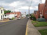
Mole Hill VA 1
Mole Hill VA 1

Mole Hill is a rounded hill composed of basalt, a volcanic rock, formed during the Eocene epoch of the Paleogene period. It is the eroded remnant of what was an active volcano approximately 47 million years ago, making it one of the youngest volcanoes on the east coast of North America. It is located west of Harrisonburg, Virginia, in Rockingham County.

Excerpt from the Wikipedia article Mole Hill (Virginia) (License: CC BY-SA 3.0, Authors, Images).

Mole Hill (Virginia)
Valley Vista Drive,

Geographical coordinates (GPS) Address Nearby Places
placeShow on map

Wikipedia: Mole Hill (Virginia)Continue reading on Wikipedia

Geographical coordinates (GPS)

Latitude Longitude
N 38.448611111111 ° E -78.953333333333 °
placeShow on map

Address

Valley Vista Drive

Valley Vista Drive

Virginia, United States
mapOpen on Google Maps

Mole Hill VA 1
Mole Hill VA 1
Share experience

Nearby Places

Daniel Harrison House

Daniel Harrison House, also known as Fort Harrison, is a historic home located near Dayton, Rockingham County, Virginia. The original structure was built in 1748 as a two-story, three bay limestone dwelling, with a steep gable roof and wide chimney caps. A brick extension was added in the early 1800s. It was originally surrounded by a palisade and was reported to have an underground passage to the nearby spring. During the French and Indian War, the legislature of Virginia designated the house and surrounding property "Fort Harrison." The house is one of the oldest in the Shenandoah Valley, and is closely associated with the early history of Rockingham County.The home's original owner, Captain Daniel Harrison, was one of the first to use the plentiful supply of limestone for building. His stone house is referred to in one of his first deeds, dated February 28, 1749, in Rockingham County Deed Book 2, p. 586 - "Daniel Harrison, Gent. to Arthur Johnson, 190 acres; 10 acres; Cook's Creek–Harrison's stonehouse". In 1745, Captain Harrison was appointed by the Court of Orange County, along with brother John and Robert Cravens, as overseer to lay out and clear the old Indian Road – "The Long Grey Trail" – through what is now Rockingham County. This was destined to be the most traveled highway in the Shenandoah Valley. In 1751, Capt. Harrison became Under Sheriff of Augusta CountyThe site was listed on the National Register of Historic Places in 1973.Fort Harrison is open to the public on Friday and Saturday in the summer and by appointment.