place

Portchester Community School

1939 establishments in EnglandBorough of FarehamCommunity schools in HampshireEducational institutions established in 1939Hampshire school stubs
Secondary schools in HampshireUse British English from October 2013

Portchester Community School is a mixed comprehensive community school for 11- to 16-year-olds in Portchester, England. As of January 2015, the date of the last Ofsted inspection, the school has been rated overall as 'good'.

Excerpt from the Wikipedia article Portchester Community School (License: CC BY-SA 3.0, Authors).

Portchester Community School
White Hart Lane,

Geographical coordinates (GPS) Address Phone number Website External links Nearby Places
placeShow on map

Wikipedia: Portchester Community SchoolContinue reading on Wikipedia

Geographical coordinates (GPS)

Latitude Longitude
N 50.84219 ° E -1.12747 °
placeShow on map

Address

Portchester Community School

White Hart Lane
PO16 9BD , Portchester
England, United Kingdom
mapOpen on Google Maps

Phone number

call+442392364399

Website
portchester.hants.sch.uk

linkVisit website

linkWikiData (Q7231534)
linkOpenStreetMap (66942118)

Share experience

Nearby Places

Portchester Castle
Portchester Castle

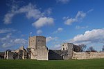
Portchester Castle is a medieval fortress that was developed within the walls of the Roman Saxon Shore fort of Portus Adurni at Portchester, to the east of Fareham in Hampshire. The keep was probably built in the late 11th century as a baronial castle and Portchester was taken under royal control in 1154. The monarchy controlled the castle for several centuries and it was a favoured hunting lodge of King John. It was besieged and captured by the French in 1216 before permanently returning to English control shortly thereafter. Occupying a commanding position at the head of Portsmouth Harbour, in the medieval period Portchester was an important port. The castle saw the embarkation for several campaigns to France led by England's kings. In anticipation of a French invasion during the first quarter of the 14th century, Edward II spent £1,100 repairing and reinforcing Portchester Castle. A plot to overthrow Henry V was discovered and the culprits apprehended at Portchester; this event features in Shakespeare's play, Henry V. Later in its history, the castle was used as a prison. Today Portchester Castle is a Scheduled Ancient Monument, and a Grade I listed building. The castle has been in the ownership of the Southwick Estate since the 17th century but is managed by English Heritage and open to visitors throughout the year. The Norman church, St. Mary's, which stands in the south-east corner of the grounds, falls within the Anglican Diocese of Portsmouth.

Portsmouth Harbour
Portsmouth Harbour

Portsmouth Harbour is a 1,264.2-hectare (3,124-acre)/12.6 km2 (4.9 sq mi) biological Site of Special Scientific Interest between Portsmouth and Gosport in Hampshire. It is a Ramsar site and a Special Protection Area. It is a large natural harbour in Hampshire, England. Geographically it is a ria: formerly it was the valley of a stream flowing from Portsdown into the Solent. At its north end is Portchester Castle, of Roman origin and the first fortress built to protect the harbour. The mouth of the harbour provides access to the Solent. It is best known as the home of the Royal Navy, HMNB Portsmouth. Because of its strategic location on the south coast of England, protected by the natural defence of the Isle of Wight, it has since the Middle Ages been the home to England's (and later Britain's) navy. The narrow entrance, and the forts surrounding it gave it a considerable advantage of being virtually impregnable to attack from the sea. Before the fortifications were built the French burned Portsmouth in 1338. During the civil war parliamentary forces were able to carry out a successful cutting-out expedition within the harbour and capture the six-gunned Henrietta Marie.In modern times, the harbour has become a major commercial ferry port, with regular services to Caen, France, Cherbourg, France, St Malo, France, The Channel Islands and the Isle of Wight. There is a passenger ferry to Gosport. It is also a major area for leisure sailing. In 2001 the Gunwharf Quays development, was opened on the site of HMS Vernon (a former naval shore establishment).

Nelson Monument, Portsdown Hill

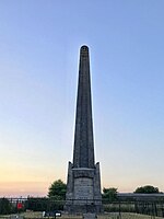
The Nelson Monument, 120 feet (37 m) tall on a granite base, stands on Portsdown Hill about 2 miles (3.2 km) north of Portsmouth Harbour on the south coast of England. It was the eventual outcome of a movement started during Horatio Nelson's lifetime to "perpetuate the glorious victories of the British Navy". By 1799 Nelson's prize agent Alexander Davison was able to use the Nelson name to spearhead a campaign to honour "Britain's naval glory and pre-eminence". It was, however, Nelson's death at Trafalgar, 21 October 1805, that galvanized the campaign.A design for the monument by John Thomas Groves of the Board of Works was exhibited at the Royal Academy in 1807, The monument is modelled on the Aksum Stele, Ethiopia: Groves was inspired by the findings in Aksum of Henry Salt who visited Ethiopia in 1805.However, letters were written to The Times asking where the money Davison had raised had gone, but the £4050 he raised was never recovered. The final (and successful) attempt was paid for by the Navy itself. This time the fund's driving force, Captain Thomas Fremantle, adopted a more altruistic approach, and the monument commenced construction on 4 July 1807 with the final checks to the inscription made just over a year later. The monument was rebuilt in 1899, but the bust is the original. The monument still serves as a navigation mark, used in compass corrections. Although very near the town of Fareham, the monument falls within the boundary of Winchester City Council. The adjacent Fort Nelson, Portsmouth, completed in 1871 as another Napoleon threatened England's south coast, is so named because of its proximity to the monument.

Portsdown Hill
Portsdown Hill

Portsdown Hill is a long chalk ridge in Hampshire, England. The highest point of the hill lies within Fort Southwick at 131m above sea level. The ridge offers good views to the south over Portsmouth, the Solent, Hayling Island and Gosport, with the Isle of Wight beyond. The hill is on the mainland, just to the north of Ports Creek, which separates the mainland from Portsea Island, on which lies the main part of the city of Portsmouth, one of the United Kingdom's main naval bases. To the north lies the Forest of Bere, with the South Downs visible in the distance. Butser Hill can be seen on a clear day. The hill is formed from an inlier of chalk which has been brought to the surface by an east–west upfold of the local strata known as the Portsdown Anticline.Southwick House is close by the north side of the hill, the HQ for U.S. General Dwight D. Eisenhower during the D-Day invasions; the generals prayed together before D-Day at Christ Church Portsdown, on the hill, which has a memorial window. The A3(M) motorway cuts through the east side of the hill while the original A3 climbs over the centre by the George Inn pub and Christ Church. The nearest railway stations (from west to east) are Portchester, Cosham and Bedhampton. There are many stories about real and imagined tunnels in the hill. The area contains active military research establishments, including one of the core sites of Dstl (known as Dstl Portsdown West) and sites run by QinetiQ. Part of the hill has been designated a Site of Special Scientific Interest. Most of the southern flank of the ridge is designated as access land under the Countryside and Rights of Way Act 2000 and thereby freely available for the public to enjoy on foot.During the early part of the English Civil War, Royalist forces from Portsmouth were involved in a number of skirmishes with Parliamentarians on the hill In the Victorian era the hill was home to a fair on Easter Mondays.