place

Cowley railway station

Cowley, LondonDisused railway stations in the London Borough of HillingdonFormer Great Western Railway stationsFormer buildings and structures in the London Borough of HillingdonPages with no open date in Infobox station
Railway stations in Great Britain closed in 1962Railway stations in Great Britain opened in 1904Use British English from January 2018
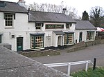
Cowley station site geograph 3322897 by Ben Brooksbank

Cowley Railway Station was a station on the Uxbridge branch of the Great Western Railway in Cowley, London. The station was opened to serve the small settlement of Cowley. It opened in 1904, nearly fifty years after the rest of the line from West Drayton had been constructed. It was the only intermediate station on the line, situated between Uxbridge Vine Street and West Drayton railway station. It closed to passengers on 10 September 1962, along with the remainder of the branch, but freight trains went through to Uxbridge Vine Street until 1964. Only the stretch of the line from West Drayton Station to the Grand Union Canal survived longer. This was for a freight service to the Middlesex Oil and Chemical Works in Yiewsley which stopped in 1979. Cowley station has since been demolished and built over, and today there are only a few signs of its former existence, including a railway bridge and "Station Road". The station had two platforms, a station building on the southbound platform and a small shelter (also pre-1940, a ticket machine) on the other.It was once part of early 20th century plans for a longer rail line from Denham to Staines via Uxbridge and West Drayton but the section linking Uxbridge High Street railway station and a point south of Uxbridge Vine Street was not built.

Excerpt from the Wikipedia article Cowley railway station (License: CC BY-SA 3.0, Authors, Images).

Cowley railway station
Huxley Close, London Cowley (London Borough of Hillingdon)

Geographical coordinates (GPS) Address Nearby Places
placeShow on map

Wikipedia: Cowley railway stationContinue reading on Wikipedia

Geographical coordinates (GPS)

Latitude Longitude
N 51.5295 ° E -0.4763 °
placeShow on map

Address

Huxley Close

Huxley Close
UB8 3PG London, Cowley (London Borough of Hillingdon)
England, United Kingdom
mapOpen on Google Maps

Cowley station site geograph 3322897 by Ben Brooksbank
Share experience

Nearby Places

Uxbridge
Uxbridge

Uxbridge () is a suburban town in west London and the administrative headquarters of the London Borough of Hillingdon. Situated 15.4 miles (24.8 km) west-northwest of Charing Cross, it is one of the major metropolitan centres identified in the London Plan. Uxbridge formed part of the parish of Hillingdon in the county of Middlesex, and was a significant local commercial centre from an early time. As part of the suburban growth of London in the 20th century it expanded and increased in population, becoming a municipal borough in 1955, and has formed part of Greater London since 1965. A few major events have taken place in and around the town, including attempted negotiations between King Charles I and the Parliamentary Army during the English Civil War. The public house at the centre of those events, since renamed the Crown & Treaty, still stands. RAF Uxbridge houses the Battle of Britain Bunker, from where the air defence of the south-east of England was coordinated during the Battle of Britain especially from its No. 11 Group Operations Room, also used during the D-Day landings. Today the town serves as a significant retail and commercial centre; it is also considered as a university town as it houses Brunel University London as well as the Uxbridge campus of Buckinghamshire New University. A part of the town which has large converted flour mills adjoins Buckinghamshire, the boundary being the River Colne. Government data analysts have confirmed within its Borough are suburbs Harefield, Ickenham, Hillingdon, Newyears Green and Cowley; with Uxbridge these are represented by six electoral wards (units for the election of councillors to Hillingdon Council and commonly for statistical purposes). The 2011 Census recorded a population figure of 70,560 for these wards combined.

RAF Uxbridge
RAF Uxbridge

RAF Uxbridge was a Royal Air Force (RAF) station in Uxbridge, within the London Borough of Hillingdon, occupying a 44.6-hectare (110-acre) site that originally belonged to the Hillingdon House estate. The British Government purchased the estate in 1915, three years before the founding of the RAF. Until the outbreak of the Second World War in 1939, the station was open to the public. The station is best known as the headquarters of No. 11 Group RAF, which was responsible for the aerial defence of London and the south-east of England during the Battle of Britain. Hillingdon House served as the group's headquarters. A bunker, subsequently known as the Battle of Britain Bunker, was built nearby to house the 11 Group Operations Room, which controlled fighter squadrons operating within the group. The Operations Room was also responsible for providing air support during the evacuation of Dunkirk in May 1940 (Operation Dynamo) and the D-Day landings (Operation Overlord). It was here that Winston Churchill first said, "Never in the history of mankind has so much been owed by so many to so few", which he repeated in a speech to Parliament four days later. RAF Uxbridge closed on 31 March 2010 as part of a reduction in the number of Ministry of Defence installations in the Greater London area. Many of its remaining military units were relocated to nearby RAF Northolt the following day. Plans for redevelopment, consisting of a mixture of new residential and commercial properties and the retention of all listed buildings, were approved in January 2011. A small part of the station incorporating the Battle of Britain Bunker retains the RAF Uxbridge name and is owned by Hillingdon Council. The River Pinn runs through the site from north to south, passing Hillingdon House and the Battle of Britain Bunker. The land around the river is mainly wooded and designated as greenbelt, and Hillingdon Golf Course borders the south of the station. A footpath through the site that had closed in 1988 was reopened in 2011.