place

Crast' Agüzza

Alpine three-thousandersBernina RangeEngadinGraubünden mountain stubsInternational mountains of Europe
Italy–Switzerland borderLombardy mountain stubsMountains of GraubündenMountains of ItalyMountains of SwitzerlandMountains of the AlpsPontresinaProvince of Sondrio geography stubsThree-thousanders of Switzerland
Crast' agüzza
Crast' agüzza

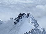
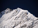
Crast' Agüzza (, known also as Cresta Güzza) (3,869 m) is a mountain in the Bernina Range in Italy and Switzerland. The peak is bounded to the north by the Morteratsch Glacier and to the south by the Upper Scerscen Glacier. To its immediate north-west lies the Fuorcla Crast' Agüzza (3,601 m); according to Collomb, this is 'the most important glacier pass across the central Bernina Alps; comparable in position with Col du Géant in the Mont Blanc range.' The first party to reach the pass (from the north) comprised E. S. Kennedy and J. F. Hardy, with guides Peter and F. Jenny and A. Flury, on 23 July 1861. The first party to traverse the col comprised Francis Fox Tuckett and E. N. Buxton together with guides Peter Jenny, Christian Michel and Franz Biner on 28 July 1864.The usual ascent is made via the rocky east ridge from the Fuorcla da l'Argient. This route was first ascended by Emil Burckhardt with Hans Grass and Peter Egger in August 1874.The mountain is known locally as the Engadin Matterhorn.[1]

Excerpt from the Wikipedia article Crast' Agüzza (License: CC BY-SA 3.0, Authors, Images).

Crast' Agüzza
Pizzo Bernina - Via Normale, Comunità montana della Valtellina di Sondrio

Geographical coordinates (GPS) Address Nearby Places
placeShow on map

Wikipedia: Crast' AgüzzaContinue reading on Wikipedia

Geographical coordinates (GPS)

Latitude Longitude
N 46.380555555556 ° E 9.9069444444444 °
placeShow on map

Address

Pizzo Bernina - Via Normale

Pizzo Bernina - Via Normale
23020 Comunità montana della Valtellina di Sondrio
Lombardy, Italy
mapOpen on Google Maps

Crast' agüzza
Crast' agüzza
Share experience

Nearby Places

Morteratsch Glacier
Morteratsch Glacier

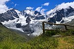
The Morteratsch Glacier (Romansh: Vadret da Morteratsch) is the largest glacier by area in the Bernina Range of the Bündner Alps in Switzerland.By area and by volume (1.2 km3), it is the third largerst glacier in the eastern alps, after the Pasterze Glacier and Gepatschferner. The Morteratsch Glacier is a typical valley glacier with a pronounced ice front. The accumulation zone lies between the peaks of Piz Morteratsch, Piz Bernina, Crast' Agüzza, Piz Argient, Piz Zupò and Bellavista. From Piz Argient to the ice front in the Val Morteratsch, its horizontal extent is less than ~6 km (3.7 mi), with an altitude difference of up to 2,000 m (6,600 ft).Together with the Pers Glacier, originating at Piz Palü, which joins the Morteratsch just below the rock formation Isla Persa ("Lost Isle"), as of 1973 it covered an area of about 16 km2 (6.2 sq mi). The volume of the ice is estimated to be about 1.2 km3. The Morteratsch Glacier drains into the Ova da Morteratsch, which eventually flows into the Inn and hence via the Danube into the Black Sea.In spring, depending on the snow conditions, a 10-km-long ski-run accessible to skilled skiers is marked on the glacier. It leads from the Diavolezza aerial tramway terminus to the Morteratsch inn and has an altitude difference of 1,100 m (3,600 ft). The Morteratsch railway station used to be situated directly at the ice front of the glacier. The ice front has receded over 2,800 m (9,200 ft) in the meantime (as of 2016), and can no longer be seen from the station.Yearly length change measurements have been recorded since 1878. For the period to 1998, the overall retreat was over 1.8 km (1.1 mi) with a mean annual retreat rate of approximately 17.2 m (56 ft) per year. This long-term average has markedly increased in recent years, receding 30 m (98 ft) per year from 1999–2005. Substantial retreat was ongoing through 2006 as well. During the last ten years, it lost another 1 kilometre (0.62 mi).During the time that measurements have been taken, the glacier has advanced a few meters in only four years. Since the large glaciers react slowly to short-term climate changes, these advances cannot be accounted for by increased precipitation in the accumulation zone in the previous winter. On the high moraines to the left and right of the ice front, which are still nearly free of overgrowth, the enormous quantities of ice which were still being pushed down here at the end of the "Little Ice Age" in the middle of the 19th century can be seen.In 2017, researchers began developing a snowmaking system to protect the glacier's ice, with a goal of covering square kilometer in 13 feet of snow. It was estimated that a decade of use might make a difference in length of 400-500 meters.