Piz Bernina

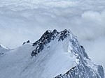
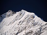
Piz Bernina (Romansh, Italian: Pizzo Bernina, Italian pronunciation: [ˈpittso berˈniːna]) is the highest mountain in the Eastern Alps, the highest point of the Bernina Range, and the highest peak in the Rhaetian Alps. It rises 4,048.6 m (13,283 ft) and is located south of Pontresina and near the major Alpine resort of St. Moritz, in the Engadin valley. It is also the most easterly mountain higher than 4,000 m (13,000 ft) in the Alps, the highest point of the Swiss canton of Graubünden, and the fifth-most prominent peak in the Alps. Although the summit lies within Switzerland, the massif is on the border with Italy. The "shoulder" (4,020 m (13,190 ft)) known as La Spedla is the highest point in the Italian Lombardy region. Piz Bernina is entirely surrounded by glaciers, of which the largest is the Morteratsch Glacier. The mountain was named after the Bernina Pass in 1850 by Johann Coaz, who also made the first ascent. The prefix Piz comes from the Romansch language in Graubünden; any mountain with that name can be readily identified as being located in southeastern Switzerland.
Excerpt from the Wikipedia article Piz Bernina (License: CC BY-SA 3.0, Authors, Images).Piz Bernina
Pizzo Bernina - Via Normale, Comunità montana della Valtellina di Sondrio
Geographical coordinates (GPS) Address Nearby Places Show on map
Geographical coordinates (GPS)
| Latitude | Longitude |
|---|---|
| N 46.382222222222 ° | E 9.9080555555556 ° |
Address
Pizzo Bernina - Via Normale
Pizzo Bernina - Via Normale
23020 Comunità montana della Valtellina di Sondrio
Lombardy, Italy
Open on Google Maps


