place

Barrett Mountain

Mountains of Hillsborough County, New HampshireMountains of New HampshireNew Hampshire geography stubsNew Ipswich, New Hampshire

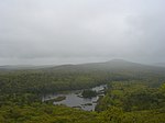
Barrett Mountain is a mountain located in south-central New Hampshire within the Wapack Range of mountains. It lies within the town of New Ipswich and is traversed by the 22-mile (35 km) Wapack Trail. Kidder Mountain is located directly to the north along the Wapack ridgeline; New Ipswich Mountain to the south. The summit of the mountain is mostly wooded. A cross-country ski area occupies the north side of Barrett Mountain. The east side of the mountain drains into the Souhegan River watershed, to the Merrimack River thence the Atlantic Ocean; the northwest side drains into the Gridley River, to the Contoocook River thence into the Merrimack River; the southwest side drains into the Millers River watershed, to the Connecticut River, thence into Long Island Sound.

Excerpt from the Wikipedia article Barrett Mountain (License: CC BY-SA 3.0, Authors).

Barrett Mountain
Wapack Trail,

Geographical coordinates (GPS) Address Nearby Places
placeShow on map

Wikipedia: Barrett MountainContinue reading on Wikipedia

Geographical coordinates (GPS)

Latitude Longitude
N 42.7617525 ° E -71.9153555 °
placeShow on map

Address

Wapack Trail

Wapack Trail
03071
New Hampshire, United States
mapOpen on Google Maps

Share experience

Nearby Places

Wapack Range
Wapack Range

The Wapack Range, sometimes referred to as the Pack Monadnock Range, is a 20-mile-long (32 km) range of mountains in south-central New Hampshire and adjacent Massachusetts, in the northeastern United States. The range is considered very scenic and rugged with many bare summits and ledges ranging from 1,800 to 2,290 feet (550 to 700 m). The 22-mile (35 km) Wapack Trail, one of the oldest interstate hiking trails in the United States, traverses it. The Wapack Range is also the northern terminus of the 90-mile (140 km) Midstate Trail. The range, composed of heavily metamorphosed schist and quartzite, is oriented north–south and is located in the towns of New Ipswich, Temple, Sharon, Peterborough, and Greenfield, New Hampshire; and in Massachusetts, the towns of Ashburnham and Ashby. Notable peaks include, from south to north, Mount Watatic, Pratt Mountain, New Ipswich Mountain, Barrett Mountain, Kidder Mountain, Temple Mountain, Pack Monadnock and North Pack Monadnock. Significant parcels on the Wapack Range have been conserved as state parks, state forests, or properties managed by non-profit land conservation organizations. Miller State Park, the oldest state park in New Hampshire, is located on Pack Monadnock. A defunct ski area on Temple Mountain was acquired by the state of New Hampshire in 2006 and is also slated for state park status. Windblown Ski Area, on and around Barrett Mountain, is one of the oldest operating cross country ski areas in the United States. Conservation efforts on Mount Watatic have resulted in the protection of the mountain from recent attempts to blast a communications tower road to the summit and open the mountain to housing development on the location of another former ski area. The non-profit Friends of the Wapack have been involved in conservation of the range since 1985.