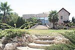
Wadi Fukin
Bethlehem GovernorateMunicipalities of the State of PalestineSeam ZoneVillages in the West Bank

Wadi Fukin (Arabic: وادي فوقين) is a Palestinian village in the West Bank, eight kilometers southwest of Bethlehem in the Bethlehem Governorate. The village, is located on 700 acres of land, between the Green Line and the Israeli West Bank barrier, According to the Palestinian Central Bureau of Statistics, Wadi Fukin had a population of over 1,168 in 2007. with the Israeli settlement of Beitar Illit on one side, and the Israeli town of Tzur Hadasa on the other. The village relies on agriculture as its primary source of income. Israel served eviction orders on the village in September 2014.Ahmad Sukkar is the head of the village council.
Excerpt from the Wikipedia article Wadi Fukin (License: CC BY-SA 3.0, Authors, Images).Wadi Fukin
Geographical coordinates (GPS) Address Nearby Places Show on map
Geographical coordinates (GPS)
| Latitude | Longitude |
|---|---|
| N 31.706666666667 ° | E 35.103888888889 ° |
Address
Palestinian Territories
Open on Google Maps


