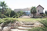
Battir

Battir (Arabic: بتير) is a Palestinian village in the Bethlehem Governorate of the State of Palestine, in the West Bank, 6.4 km west of Bethlehem, and southwest of Jerusalem. In 2017, the village had a population of 4,696. In 2014, Battir was inscribed in the List of World Heritage Sites as a World Heritage Site in the State of Palestine, under the name Battir – Land of Olives and Vines — Cultural Landscape of Southern Jerusalem. Battir was inhabited during the Byzantine and Islamic periods, and in the Ottoman and British Mandate censuses its population was recorded as primarily Muslim. In former times, the city lay along the route from Jerusalem to Bayt Jibrin. Battir is situated just above the modern route of the Jaffa–Jerusalem railway, which served as the armistice line between Israel and Jordan from 1949 until the Six-Day War, when it was occupied by Israel. In 2007, Battir had a population of about 4,000.
Excerpt from the Wikipedia article Battir (License: CC BY-SA 3.0, Authors, Images).Battir
Geographical coordinates (GPS) Address Nearby Places Show on map
Geographical coordinates (GPS)
| Latitude | Longitude |
|---|---|
| N 31.724722222222 ° | E 35.136666666667 ° |
Address
Palestinian Territories
Open on Google Maps


