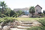
Tzur Hadassah
1960 establishments in IsraelJerusalem DistrictLocal councils in Jerusalem DistrictPopulated places established in 1960Populated places in Jerusalem District

Tzur Hadassah (Hebrew: צוּר הֲדַסָּה, lit. Rock of Hadassah) is a local council located in the Jerusalem Corridor, located 12 kilometres (7.5 mi) southwest of Jerusalem, at an altitude of 755 meters above sea level, located on Route 375 west of Betar Ilit, about one kilometer west of the Green Line, adjacent to the Palestinian village of Wadi Fukin. In 2021 it had a population of 11,930. In 2023 it was awarded Local council (Israel) status.
Excerpt from the Wikipedia article Tzur Hadassah (License: CC BY-SA 3.0, Authors, Images).Tzur Hadassah
Dafna,
Geographical coordinates (GPS) Address Nearby Places Show on map
Geographical coordinates (GPS)
| Latitude | Longitude |
|---|---|
| N 31.719166666667 ° | E 35.0975 ° |
Address
דפנה
Dafna
9987500 , The old neighborhood
Jerusalem District, Israel
Open on Google Maps


