Woodend, Northamptonshire
Civil parishes in NorthamptonshireNorthamptonshire geography stubsUse British English from May 2011Villages in NorthamptonshireWest Northamptonshire District

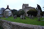
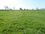
Woodend is a small village in West Northamptonshire in the English county of Northamptonshire. The village's name means 'at the end of the wood'.It is 6 miles (9.7 km) west of the town of Towcester and was a hamlet in the parish of Blakesley until 1866, when it became a parish in its own right. After World War I it was designated a "thankful village", all of the soldiers it sent to war having returned safely. The population of the village at the 2011 Census was 322. There is a Barrow about 250 yards east of Green's Park Farm.
Excerpt from the Wikipedia article Woodend, Northamptonshire (License: CC BY-SA 3.0, Authors, Images).Woodend, Northamptonshire
Main Street,
Geographical coordinates (GPS) Address Nearby Places Show on map
Geographical coordinates (GPS)
| Latitude | Longitude |
|---|---|
| N 52.1368 ° | E -1.1017 ° |
Address
Main Street
Main Street
NN12 8RX , Woodend
England, United Kingdom
Open on Google Maps


