place

Timberscombe

Civil parishes in SomersetExmoorVillages in West Somerset
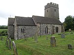
St. Petrock's church, Timberscombe geograph.org.uk 679109

Timberscombe is a village and civil parish on the River Avill 2.5 miles (4 km) south-west of Dunster, and 5.5 miles (9 km) south of Minehead within the Exmoor National Park in Somerset, England. The parish includes the hamlet of Bickham.

Excerpt from the Wikipedia article Timberscombe (License: CC BY-SA 3.0, Authors, Images).

Geographical coordinates (GPS)

Latitude Longitude
N 51.1382 ° E -3.5389 °
placeShow on map

Address

Exmoor House

A396
TA24 7DU
England, United Kingdom
mapOpen on Google Maps

St. Petrock's church, Timberscombe geograph.org.uk 679109
Share experience

Nearby Places

Brendon Hills
Brendon Hills

The Brendon Hills are a range of hills in west Somerset, England. The hills merge level into the eastern side of Exmoor and are included within the Exmoor National Park. The highest point of the range is Lype Hill at 1,388 feet (423 m) above sea level with a secondary summit several kilometres to the southeast at 1,350 feet (411 m). Both points are marked by Ordnance Survey trig points and are located within enclosed farmland. Early versions of the name include Brunedun and Brundon reflecting an original name of Bruna or Brune, meaning 'brown one'. Dun is a common Old English word for a fairly flat and extensive hill. This name is not connected with the village of Brendon in Devon, the name of which has a different origin.The terrain is broken by a series of deeply incised streams and rivers running roughly southwards to meet the River Haddeo, a tributary of the River Exe. The hills are quite heavily cultivated unlike their neighbouring upland areas of Exmoor and the Quantock Hills. The Brendon Hills are largely formed from the Morte Slates, a thick faulted and folded sequence of Devonian age sedimentary rocks. An east-west aligned anticline/syncline pair known as the Brendon Anticline and Brendon Syncline folds these rocks. The fold couplet is itself offset by displacement of the rocks on the NNW-SSE aligned Timberscombe Fault System. Over the centuries they have been mined for minerals, notably ironstone from which iron is extracted for making steel. During the 19th century this activity reached a peak with the West Somerset Mineral Railway, including an 800 feet (244 m) incline, being built to take the ore to Watchet from where it was sent to Ebbw Vale for smelting. The main mining operations ended when the mines were worked out towards the end of the 19th century. The hills are on the route of the Coleridge Way and are also crossed by the Samaritans Way.

Exmoor
Exmoor

Exmoor is loosely defined as an area of hilly open moorland in west Somerset and north Devon in South West England. It is named after the River Exe, the source of which is situated in the centre of the area, two miles north-west of Simonsbath. Exmoor is more precisely defined as the area of the former ancient royal hunting forest, also called Exmoor, which was officially surveyed 1815–1818 as 18,810 acres (7,610 ha) in extent. The moor has given its name to a National Park, which includes the Brendon Hills, the East Lyn Valley, the Vale of Porlock and 55 km (34 mi) of the Bristol Channel coast. The total area of the Exmoor National Park is 692.8 km2 (267.5 sq mi), of which 71% is in Somerset and 29% in Devon. The upland area is underlain by sedimentary rocks dating from the Devonian and early Carboniferous periods with Triassic and Jurassic age rocks on lower slopes. Where these reach the coast, cliffs are formed which are cut with ravines and waterfalls. It was recognised as a heritage coast in 1991. The highest point on Exmoor is Dunkery Beacon; at 519 metres (1,703 ft) it is also the highest point in Somerset. The terrain supports lowland heath communities, ancient woodland and blanket mire which provide habitats for scarce flora and fauna. There have also been reports of the Beast of Exmoor, a cryptozoological cat roaming Exmoor. Several areas have been designated as Nature Conservation Review and Geological Conservation Review sites. There is evidence of human occupation from the Mesolithic. This developed for agriculture and extraction of mineral ores into the Bronze and Iron Ages. The remains of standing stones, cairns and bridges can still be identified. The royal forest was granted a charter in the 13th century, however foresters who managed the area were identified in the Domesday Book. In the Middle Ages sheep farming was common with a system of agistment licensing the grazing of livestock as the Inclosure Acts divided up the land. The area is now used for a range of recreational purposes.