Winsford, Somerset
Archaeological sites in SomersetBronze Age sites in SomersetCivil parishes in SomersetExmoorVillages in West Somerset

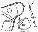
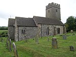
Winsford is a village and civil parish in Somerset, England, located about 5 miles (8 km) north-west of Dulverton. It is within the borders of the Exmoor National Park and around 10 miles (16.1 km) south-west of the coastal town of Minehead. The village has one hotel, The Royal Oak dating to before the start of the 16th century, and one shop and post office. There is also a tea garden and a service station, which does not serve fuel for motor vehicles. The village is on the route of the Samaritans Way South West and is located within the Exmoor National Park, to the east of the village is the hamlet of West Howetown.
Excerpt from the Wikipedia article Winsford, Somerset (License: CC BY-SA 3.0, Authors, Images).Winsford, Somerset
Halse Lane,
Geographical coordinates (GPS) Address Nearby Places Show on map
Geographical coordinates (GPS)
| Latitude | Longitude |
|---|---|
| N 51.0993 ° | E -3.5652 ° |
Address
Halse Lane
Halse Lane
TA24 7JE , Winsford
England, United Kingdom
Open on Google Maps


