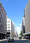
Cavendish Square

Cavendish Square is a public garden square in Marylebone in the West End of London. It has a double-helix underground commercial car park. Its northern road forms ends of four streets: of Wigmore Street that runs to Portman Square in the much larger Portman Estate to the west; of Harley Street which runs an alike distance; of Chandos Street which runs for one block and; of Cavendish Place which runs the same. The south side itself is modern: the rear façade and accesses to a flagship department store and office block. On the ground floors facing are Comptoir Libanais, Royal Bank of Scotland and Pret a Manger premises. Oxford Circus 150m south-east is where two main shopping streets meet. Only the south is broken by a full-width street, Holles Street. which also runs one block only; the north is broken by Dean's Mews in which Nos. 11–13 exist, the office conversion of a nunnery, retaining a chapel in its rear. Planning permission was granted in April 2020 for a subterranean health and wellbeing development of 280,000 square feet across four storeys below ground level.
Excerpt from the Wikipedia article Cavendish Square (License: CC BY-SA 3.0, Authors, Images).Cavendish Square
Cavendish Square, City of Westminster Fitzrovia
Geographical coordinates (GPS) Address Website Nearby Places Show on map
Geographical coordinates (GPS)
| Latitude | Longitude |
|---|---|
| N 51.5165 ° | E -0.145 ° |
Address
Oxford Street Car Park
Cavendish Square
W1G 0AN City of Westminster, Fitzrovia
England, United Kingdom
Open on Google Maps


