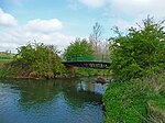
Warmington, Northamptonshire

Warmington is a village and civil parish in North Northamptonshire, England with a population of 874 (as of the 2001 census), increasing to 939 at the 2011 Census. The village's name means 'Farm/settlement which is connected with Wyrma'. It is 2+1⁄2 miles east of the town of Oundle near the Cambridgeshire border and is 10 miles south west of the city of Peterborough. It has a large 13th-century church, and fine watermill, manor house and dovecote. Most of the houses, however, were built in the 1960s and 1970s. A large estate of private homes has been added since the turn of the millennium increasing the size of the village by around 30%. Warmington is a working, functional village with some impressive old stone buildings which are considered very attractive. The Nene Way footpath runs through the village and is well signposted.
Excerpt from the Wikipedia article Warmington, Northamptonshire (License: CC BY-SA 3.0, Authors, Images).Warmington, Northamptonshire
Geographical coordinates (GPS) Address Nearby Places Show on map
Geographical coordinates (GPS)
| Latitude | Longitude |
|---|---|
| N 52.51 ° | E -0.417 ° |
Address
PE8 6TN
England, United Kingdom
Open on Google Maps


