Milber Down
Devon building and structure stubsHill forts in DevonNewton AbbotUnited Kingdom archaeology stubs

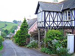
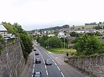
Milber Down is an Iron Age hill fort on the hill above the suburb of Milber, Newton Abbot in Devon, England. The fort is situated on the north-western slope of Milber Down at about 110 metres above sea level, and is bisected by the minor ridge road that leads to Barton, Torquay. One Iron Age artefact discovered there was a figurine of a stag.
Excerpt from the Wikipedia article Milber Down (License: CC BY-SA 3.0, Authors, Images).Milber Down
St Marychurch Road, Teignbridge Haccombe with Combe
Geographical coordinates (GPS) Address Nearby Places Show on map
Geographical coordinates (GPS)
| Latitude | Longitude |
|---|---|
| N 50.514 ° | E -3.564 ° |
Address
St Marychurch Road
St Marychurch Road
TQ12 4SE Teignbridge, Haccombe with Combe
England, United Kingdom
Open on Google Maps


