Calleva Atrebatum
Archaeological sites in HampshireBasingstoke and DeaneEnglish Heritage sites in HampshireFormer populated places in HampshireHistory of Hampshire ... and 4 more
Iron Age sites in EnglandPopulated places established in the 1st century BCRoman towns and cities in EnglandTourist attractions in Hampshire

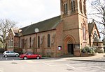
Calleva Atrebatum ("Calleva of the Atrebates") was an Iron Age settlement, as capital of the Atrebates tribe. It then became a walled town in the Roman province of Britannia at a major crossroads in the Roman roads of Britain. Its ruins lie to the west of, and partly beneath, the Church of St Mary the Virgin, Silchester, in Hampshire, England. The church occupies a site just within the ancient walls but the village of Silchester is about a mile (1.6 km) to the west.
Excerpt from the Wikipedia article Calleva Atrebatum (License: CC BY-SA 3.0, Authors, Images).Calleva Atrebatum
The Drove, Basingstoke and Deane
Geographical coordinates (GPS) Address Website External links Nearby Places Show on map
Geographical coordinates (GPS)
| Latitude | Longitude |
|---|---|
| N 51.357222222222 ° | E -1.0825 ° |
Address
Calleva Atrebatum
The Drove
RG7 2HJ Basingstoke and Deane
England, United Kingdom
Open on Google Maps


