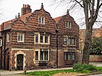
Clifton, York
Use British English from October 2018Villages and areas in the City of York

Clifton is a suburb of York in the unitary authority of the City of York, in the north of England about 1+1⁄2 miles from the city centre. The A19, passes north out of York through Clifton. The old village area was made a Conservation Area in 1968. It is the location of Nestle Foods Factory and the Public School of St Peter's and the former Queen Anne's Grammar School. The origin of the name is derived from the Old English pre-7th century clif, meaning a gentle slope, or more usually a riverbank, with tun, an enclosure or settlement.
Excerpt from the Wikipedia article Clifton, York (License: CC BY-SA 3.0, Authors, Images).Clifton, York
Hudson Crescent, York Clifton
Geographical coordinates (GPS) Address Nearby Places Show on map
Geographical coordinates (GPS)
| Latitude | Longitude |
|---|---|
| N 53.97206 ° | E -1.09791 ° |
Address
Hudson Crescent
Hudson Crescent
YO30 6NL York, Clifton
England, United Kingdom
Open on Google Maps


