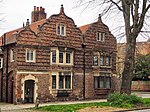
Clifton Without
Clifton Without is a suburb and civil parish in the unitary authority area of the City of York, North Yorkshire, England. It consists of those parts of Clifton that lie outside, i.e. Without, the (pre-1996) city boundaries and Clifton Moor. It lies on the A19 about two miles north-west of central York. According to the 2001 census it had a population of 5,113, increasing to 5,246 at the 2011 Census. Before 1996 it formed part of the Ryedale district. The Parish is bounded by the River Ouse to the west and the B1363 road and River Foss in the east, and from the Clifton Moor retail park in the north to near Clifton Green in the south. The parish contains a diverse mix of industrial and retail areas, to residential areas in the rest of the parish. The area also includes the natural areas of Clifton Ings and Clifton Backies and Rawcliffe Lake.
Excerpt from the Wikipedia article Clifton Without (License: CC BY-SA 3.0, Authors).Clifton Without
Rawcliffe Lane, York Clifton Moor
Geographical coordinates (GPS) Address Nearby Places Show on map
Geographical coordinates (GPS)
| Latitude | Longitude |
|---|---|
| N 53.975781 ° | E -1.103031 ° |
Address
Rawcliffe Lane
Rawcliffe Lane
YO30 5SD York, Clifton Moor
England, United Kingdom
Open on Google Maps


