place

West Cold Spring station

1983 establishments in MarylandMaryland railway station stubsMetro SubwayLink stationsRailway stations in BaltimoreRailway stations in the United States opened in 1983
United States rapid transit stubs
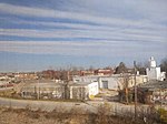
West Cold Spring station April 2019

West Cold Spring station is a Metro SubwayLink station in Baltimore, Maryland. It is located at the intersection of Wabash Avenue and Cold Spring Lane in the Arlington neighborhood, adjacent to the Towanda-Grantley neighborhood. It is the sixth most northern and western station on the line, with approximately 300 parking spaces.The station features the sculpture "Wabash Outcrop" by Jim Sanborn. In 2021, funding was allocated for a community driven public art project, Towanda LaneScape, adjacent to West Cold Spring station.

Excerpt from the Wikipedia article West Cold Spring station (License: CC BY-SA 3.0, Authors, Images).

West Cold Spring station
East Wabash Avenue, Baltimore Park Heights

Geographical coordinates (GPS) Address Nearby Places
placeShow on map

Wikipedia: West Cold Spring stationContinue reading on Wikipedia

Geographical coordinates (GPS)

Latitude Longitude
N 39.33633 ° E -76.6725 °
placeShow on map

Address

East Wabash Avenue
21215 Baltimore, Park Heights
Maryland, United States
mapOpen on Google Maps

West Cold Spring station April 2019
Share experience

Nearby Places

Park Heights, Baltimore

Park Heights is an area of Baltimore City, Maryland, that lies approximately 5 miles northwest of downtown Baltimore and within two miles of the Baltimore County line. A 1,500-acre community, Park Heights comprises 12 smaller neighborhoods that together contain approximately 30,000 residents. It is bounded on the south by Druid Park Drive, on the west by Wabash Avenue, on the east by Greenspring Avenue, and on the north by Northern Parkway. Interstate-83 is less than a half mile to the east. Two major roadways—Park Heights Avenue and Reisterstown Road—run north-south through Park Heights, serving as the neighborhood's "Main Streets" as well as commuter corridors. Limited commercial uses—primarily retail—are scattered along these roads; there is also some industrial activity on the neighborhood's western edge.Otherwise, Park Heights is characterized by residential uses, which run the spectrum from stable, well-tended streets to entire blocks of abandoned houses and lots. Major health care, educational, and social service institutions are located throughout the community, as well as one of Baltimore and the State of Maryland's most well-known landmarks, Pimlico Race Track.The boundaries of Park Heights, as defined by the Baltimore City Planning Department, are bounded north and south by Park Circle and Northern Parkway and east and west by Greenspring and Wabash Avenues, respectively; and includes the neighborhoods of Arlington, Central Park Heights, Cylburn, Greenspring, Langston Hughes, Levindale, Lucille Park, the historic Park Circle, Park Lane, Pimlico Good Neighbor, Towanda/Grantley, Woodmere. Park Heights boasts one of the largest foreign born Black populations in Baltimore City, specifically in the areas surrounding Belvedere Avenue, with immigrants from Jamaica, Trinidad, Haiti, and other Caribbean countries.