place

River Ouse, Yorkshire

Geography of YorkOuse catchmentRiver Ouse, YorkshireRiver navigations in the United KingdomRivers of North Yorkshire
Rivers of the East Riding of YorkshireUse British English from October 2013
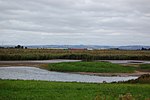
Dawn over the River Ouse geograph.org.uk 1088602

The River Ouse ( OOZ) is a river in North Yorkshire, England. Hydrologically, the river is a continuation of the River Ure, and the combined length of the River Ure and River Ouse makes it, at 129 miles (208 km), the sixth-longest river of the United Kingdom and (including the Ure) the longest to flow entirely in one county. The length of the Ouse alone is about 52 miles (84 km) but the total length of the river is disputed. It is a matter of opinion as to whether the River Ouse is formed at the confluence of the River Ure and the much-smaller Ouse Gill Beck at Cuddy Shaw Reach near Linton-on-Ouse, about six miles downstream of the confluence of the River Swale with the River Ure. An alternative opinion is recorded in a publication published in The Yorkshire Post in a series dated 1891, written and illustrated by Tom Bradley. His description and bird's-eye-view maps—specifically in his account of the River Swale—suggests that the River Ouse starts at the confluence of the Swale and the Ure. His narrative states that the Ouse has no specific source, simply flowing from the stated confluence until it runs into the Humber at the confluence of the Ouse and Trent. Continuing the path of the Ouse downstream from Linton-on-Ouse, it then flows through the city of York and the nearby towns of Selby and Goole before joining with the River Trent at Trent Falls, near the village of Faxfleet, then entering the Humber estuary. The Ouse's system of tributaries includes the Derwent, Aire, Don, Wharfe, Rother, Nidd, Swale, Ure and Foss. Together they drain a large part of the Pennines, and much of the Yorkshire Dales and North York Moors. The Ouse valley is a wide, flat plain; heavy rainfall higher in the river's drainage basin can bring severe flooding to settlements. In recent years York, Selby and villages in between have been flooded.

Excerpt from the Wikipedia article River Ouse, Yorkshire (License: CC BY-SA 3.0, Authors, Images).

Geographical coordinates (GPS)

Latitude Longitude
N 53.702222222222 ° E -0.69611111111111 °
placeShow on map

Address


DN14 7YR , Blacktoft
England, United Kingdom
mapOpen on Google Maps

Dawn over the River Ouse geograph.org.uk 1088602
Share experience

Nearby Places

Whitton Island
Whitton Island

Whitton Island is an island situated at the western end of the Humber Estuary in northern England. The almond-shaped island straddles the county boundary between the counties of East Riding of Yorkshire to the north and North Lincolnshire which otherwise runs over tidal water roughly along the centre line of the estuary. Parts of the island fall within the boundaries of four civil parishes. Despite being named after the Lincolnshire parish of Whitton, the largest part of the island is in the Yorkshire parish of Blacktoft and much of the remainder is in the neighbouring parish of Broomfleet. Much smaller parts of the southeast coast of the island fall within the Lincolnshire parishes of Alkborough and Whitton.Whitton Island is an ait (or eyot), formed by the deposit of sands and gravels washed down by the river, which accumulate over a period of time, and become consolidated by the vegetation that colonises them. Only in recent years has the island emerged sufficiently from the mud and sand bank known as Whitton Sand to be mapped by the Ordnance Survey as a new feature. Whitton Sands forms a part of the Humber Wildfowl Refuge.Whitton Island is owned by Associated British Ports who were in discussion with the RSPB during 2014 over its future management. In March 2017 the RSPB signed a 50-year lease on the then 120 hectare island to manage it as a Nature Reserve. To improve the island as a habitat for wetland birds, the RSPB dug a lagoon and several ponds. This has resulted in the arrival of increased numbers of birds some of which had not previously ventured so high up the estuary. The island now provides a safe nesting habitat for the avocet, and also good feeding and roosting areas for pink-footed geese, teal, wigeon, dunlin, spoonbills, curlew, turnstone and ringed plover.

Julian's Bower
Julian's Bower

Julian's Bower or Julian Bower is a name given to turf mazes in several different parts of England. Only one of this name still exists, at Alkborough in North Lincolnshire. It has also been known by corrupted forms of the name, such as "Gillian's Bore" and "Gilling Bore". The 18th-century antiquary William Stukeley mentions a "Julian Bower" turf maze at Horncastle, Lincolnshire, and in nearby Louth there was a "Gelyan Bower", mentioned in accounts of 1554. At Goathland, North Yorkshire, there was a "July Park" or "St Julian's" maze. At Whinfell Forest there is a farm called Julian Bower, originally built to support the Keeper. It now lies outside the forest boundary. Some English turf mazes are very similar in their layout to Scandinavian labyrinths, which usually have their paths marked with stones. At Grothornet, in Vartdal in the Sunnmore Province of Norway, there is a stone-lined labyrinth called "Den Julianske Borg" ("Julian's Castle"). The name is believed to be derived from Julus, son of Aeneas of Troy, and the word place-name element burgh, meaning "a fortified place", "fort" or "castle". The reasoning behind this etymology is based on the fact that many mazes and labyrinths in Britain were called "Troy", "Troy Town" or "The Walls of Troy"; similar names, such as "Trojaburg", "Trojburg" or "Trelleborg", were used in Scandinavia. In popular legend, the walls of the city of Troy were constructed in such a complex and confusing way that any enemy who entered them would be unable to find his way out. On a clear day, Emley Moor TV tower (40 miles), the top of York Minster and the Kilburn White Horse (45 miles) can be seen from Julian's Bower.