Faxfleet

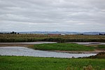
Faxfleet is a hamlet and former civil parish, now in the parish of Blacktoft, in the East Riding of Yorkshire, England. It is situated approximately 6 miles (10 km) west of Brough, and at the start of the Humber, on the north bank, where the River Ouse and the River Trent meet. In 1931 the parish had a population of 151. Faxfleet lies within the constituency of Haltemprice and Howden, an area placed as the 10th most affluent in the country in a 2003 Barclays Private Clients survey.Faxfleet was the location of the Faxfleet Preceptory, a former community of the Knights Templar. It was one of Yorkshire's principal preceptories, valued at more than £290 (equivalent to £250,000 in 2021). when it was closed in 1308. In 1823 Faxfleet was listed as in the Wapentake of Harthill. Population was 163, with occupations including three farmers and a brick & tile maker. There was a gentleman who lived at the Hall, and two yeomen.Faxfleet was formerly a township in the parish of South Cave, from 1866 Faxfleet was a civil parish in its own right, on 1 April 1935 the parish was abolished and merged with Blacktoft.
Excerpt from the Wikipedia article Faxfleet (License: CC BY-SA 3.0, Authors, Images).Faxfleet
Geographical coordinates (GPS) Address Nearby Places Show on map
Geographical coordinates (GPS)
| Latitude | Longitude |
|---|---|
| N 53.706778 ° | E -0.693107 ° |
Address
DN14 7YR , Blacktoft
England, United Kingdom
Open on Google Maps


