Adlingfleet
Former civil parishes in the East Riding of YorkshireLand drainage in the United KingdomOpenDomesdayUse British English from November 2014Villages in the East Riding of Yorkshire

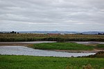
Adlingfleet is a drained, fertile, former marshland village and former civil parish, now in the parish of Twin Rivers, in the East Riding of Yorkshire, England. It is 6.5 miles (10.5 km) east-southeast of Goole town centre. Its sea wall along the far north-east is set back from the Ouse estuary leaving the largest single reedbed in England. In 1961 the parish had a population of 137.
Excerpt from the Wikipedia article Adlingfleet (License: CC BY-SA 3.0, Authors, Images).Adlingfleet
Hoggard Lane,
Geographical coordinates (GPS) Address Nearby Places Show on map
Geographical coordinates (GPS)
| Latitude | Longitude |
|---|---|
| N 53.679646 ° | E -0.723667 ° |
Address
Hoggard Lane
Hoggard Lane
DN14 8HS , Twin Rivers
England, United Kingdom
Open on Google Maps


