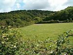
place

Othery

Civil parishes in SomersetVillages in Sedgemoor
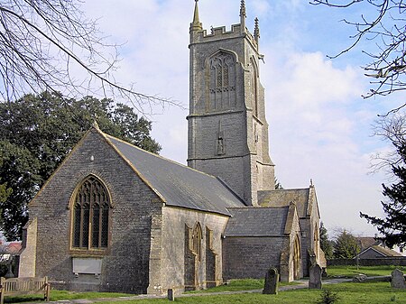
Otherychurch
Otherychurch

The parish and village of Othery, established in 1515, sits on a detached extension of Sowy island on the Somerset Levels. It is 7 miles (11 km) east of Bridgwater and 4 miles (6 km) north-west of Langport. It borders the hamlets and villages of Pathe, Burrowbridge, Middlezoy, Westonzoyland and Aller, which it meets at Beer Wall. The border with Burrowbridge was defined in 1985, reducing Othery to 553 ha (1,366 acres). Many of these borders are defined by ditches and walls created and rearranged, from the 13th century onwards, to drain and channel the waters of the River Cary and the River Parrett as they flooded the low-lying levels on their way to the Bristol Channel.

Excerpt from the Wikipedia article Othery (License: CC BY-SA 3.0, Authors, Images).

Geographical coordinates (GPS)

Latitude Longitude
N 51.08 ° E -2.88 °
placeShow on map

Address

Kingston Lane

Kingston Lane
TA7 0QS
England, United Kingdom
mapOpen on Google Maps

Otherychurch
Otherychurch
Share experience

Nearby Places

Southlake Moor
Southlake Moor

Southlake Moor (grid reference ST370300) is a 196.1 hectare (484.6 acre) biological Site of Special Scientific Interest near Burrow Mump and Burrowbridge in Somerset, notified in 1985. Southlake Moor forms part of the extensive grazing marsh and ditch system of Somerset Levels and Moors. Southlake Moor is unusual in that, when conditions in the River Parrett are suitable, it may be deliberately flooded in winter by means of a sluice in the river floodbank. Some 96 species of aquatic and bankside vascular plant species have been recorded from Southlake Moor, of particular interest is the greater water-parsnip (Sium latifolium). When the moor is flooded, large numbers of wildfowl may be present; with up to 22,000 wigeon (Anas penelope), 250 Bewick's swan (Cygnus bewickii) and good numbers of pochard (Aythya ferina), teal (Anas crecca) and tufted duck (Aythya fuligula). Regular signs of the otter (Lutra lutra) are to be seen on the muddy banks of the River Parrett. The ditches on the east side of the site contain a population of the palmate newt (Triturus helveticus).During 2009 and 2010 work was undertaken to upgrade sluice gates, watercourses and culverts to enable seasonal flooding during the winter diverting water from the Sowy River onto the moor. It has the capacity to hold 1.2 million cubic metres as part of a scheme by the Parrett Internal Drainage Board to restore ten floodplains in Somerset. In spring the water is drained away to enable the land to be used as pasture during the summer. The scheme is also used to encourage water birds.

Aller and Beer Woods

Aller and Beer Woods (grid reference ST404305) is a 56.9 hectares (141 acres) biological Site of Special Scientific Interest. off the A372 Othery to Langport road near Aller in Somerset. It was notified in 1952. This Somerset Wildlife Trust reserve, which is about 3.5 kilometres (2 mi) north-west of Langport and 11 kilometres (7 mi) south-east of Bridgwater, consists of large blocks of semi-natural ancient woodland along the west-facing slope of Aller Hill, overlooking King's Sedgemoor. The reserve is about 40 ha (99 acres) and the underlying geology of most of it is Lias limestone. Prior to the twentieth century it appears to have been managed for centuries as traditional coppice woodlandd.Aller and Beer Woods are outstanding examples of ancient, escarpment woodland managed in a traditional coppice-with-standards system. The woodland is a variant of the calcareous ash/Wych elm stand-type, with pedunculate oak (Quercus robur), and ash (Fraxinus excelsior) the dominant canopy trees throughout, and with scattered concentrations of Wych elm (Ulmus glabra). Ancient woodland indicators include small-leaved lime (Tilia cordata), and wild service tree (Sorbus torminalis), both of which are locally common. Plants of particular interest include bird's nest orchid (Neottia nidus-avis), greater butterfly orchid (Platanthera chlorantha) and the very rare Red Data Book species purple gromwell (Lithospermum purpurocaeruleum).Nearby is the Aller Hill SSSI.

River Tone
River Tone

The River Tone is a river in the English county of Somerset. The river is about 33 kilometres (21 mi) long. Its source is at Beverton Pond near Huish Champflower in the Brendon Hills, and is dammed at Clatworthy Reservoir. The reservoir outfall continues through Taunton and Curry and Hay Moors, which are designated as a Site of Special Scientific Interest. Finally, it flows into the River Parrett at Burrowbridge. An act of Parliament granted in 1699 authorised work that made the river navigable as far as Taunton. The act specified that profits should be used to benefit the poor of Taunton, but the Proprietors succeeded in avoiding their obligation until 1843, when they used the proceeds from the sale of the navigation to fund a wing of the Taunton and Somerset Hospital, and to aid the Taunton Market Trust. The Bridgwater and Taunton Canal opened in 1827, which provided an easier route than the river, and protracted legal battles followed over ownership of the river and water rights for the canal. These were not finally resolved until 1832, when the Canal Company formally took over the river navigation. The ability to navigate the river gradually deteriorated, not helped by the abandonment of the River Parrett as a navigation in 1878. Following flooding in Taunton in 1960, much of the river between there and its mouth was straightened, and the navigation locks were removed. That at Ham was blown up by the Territorial Army. Navigation rights were repealed in 1967.