place

Greylake

Geology of SomersetSites of Special Scientific Interest in SomersetSites of Special Scientific Interest notified in 1987
Greylake
Greylake

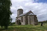
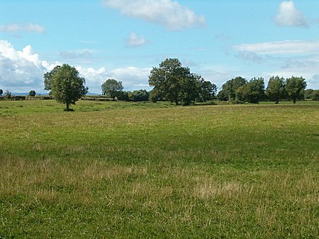
Greylake (grid reference ST384336) is a 9.3 hectare geological Site of Special Scientific Interest near Middlezoy in Somerset, notified in 1987. This site, on the Somerset Levels, consists of 20 low-lying fields in the north west corner of King's Sedgemoor, and includes the Royal Society for the Protection of Birds Greylake nature reserve which has taken over arable farmland and is now home to northern lapwings, common snipe, Eurasian curlews, redshanks, yellow wagtails, skylarks, and meadow pipits.This location is the type section for the Pleistocene Burtle Beds, as it is probably the most complete Burtle Beds sequence in Somerset. It demonstrates a sequence of fluvial (or possibly glacial) gravels, marine intertidal silts and marine subtidal. Rich molluscan, ostracod, and foraminifera assemblages and a mammalian fauna, including red deer (Cervus elephus), aurochs (Bos primigenius), and fallow deer (Dama dama) have been recorded.Greylake was flooded during the winter flooding of 2013–14 on the Somerset Levels.

Excerpt from the Wikipedia article Greylake (License: CC BY-SA 3.0, Authors, Images).

Greylake
Oliver's Road,

Geographical coordinates (GPS) Address Nearby Places
placeShow on map

Wikipedia: GreylakeContinue reading on Wikipedia

Geographical coordinates (GPS)

Latitude Longitude
N 51.09838 ° E -2.88109 °
placeShow on map

Address

Oliver's Road

Oliver's Road
TA7 0PJ , Middlezoy
England, United Kingdom
mapOpen on Google Maps

Greylake
Greylake
Share experience

Nearby Places

Southlake Moor
Southlake Moor

Southlake Moor (grid reference ST370300) is a 196.1 hectare (484.6 acre) biological Site of Special Scientific Interest near Burrow Mump and Burrowbridge in Somerset, notified in 1985. Southlake Moor forms part of the extensive grazing marsh and ditch system of Somerset Levels and Moors. Southlake Moor is unusual in that, when conditions in the River Parrett are suitable, it may be deliberately flooded in winter by means of a sluice in the river floodbank. Some 96 species of aquatic and bankside vascular plant species have been recorded from Southlake Moor, of particular interest is the greater water-parsnip (Sium latifolium). When the moor is flooded, large numbers of wildfowl may be present; with up to 22,000 wigeon (Anas penelope), 250 Bewick's swan (Cygnus bewickii) and good numbers of pochard (Aythya ferina), teal (Anas crecca) and tufted duck (Aythya fuligula). Regular signs of the otter (Lutra lutra) are to be seen on the muddy banks of the River Parrett. The ditches on the east side of the site contain a population of the palmate newt (Triturus helveticus).During 2009 and 2010 work was undertaken to upgrade sluice gates, watercourses and culverts to enable seasonal flooding during the winter diverting water from the Sowy River onto the moor. It has the capacity to hold 1.2 million cubic metres as part of a scheme by the Parrett Internal Drainage Board to restore ten floodplains in Somerset. In spring the water is drained away to enable the land to be used as pasture during the summer. The scheme is also used to encourage water birds.