place

City of Preston (Victoria)

1871 establishments in Australia1994 disestablishments in AustraliaCity of DarebinFormer local government areas of Victoria (Australia)Use Australian English from August 2019
Old lga Preston
Old lga Preston

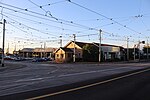
The City of Preston was a local government area about 11 kilometres (7 mi) north-northeast of Melbourne, the state capital of Victoria, Australia. The city covered an area of 37.05 square kilometres (14.31 sq mi), and existed from 1871 until 1994.

Excerpt from the Wikipedia article City of Preston (Victoria) (License: CC BY-SA 3.0, Authors, Images).

City of Preston (Victoria)
Plenty Road, Melbourne Preston

Geographical coordinates (GPS) Address Nearby Places
placeShow on map

Wikipedia: City of Preston (Victoria)Continue reading on Wikipedia

Geographical coordinates (GPS)

Latitude Longitude
N -37.743 ° E 145.008 °
placeShow on map

Address

Plenty Road 277–279
3072 Melbourne, Preston
Victoria, Australia
mapOpen on Google Maps

Old lga Preston
Old lga Preston
Share experience

Nearby Places

Electoral district of Jika Jika

The electoral district of Jika Jika was an electoral district of the Legislative Assembly in the Australian state of Victoria. The district was defined by the Electoral Districts Boundaries Act 1903:Commencing at the intersection of Nicholson-street and Scotchmer-street; thence east by Scotchmer-street to Falconer-street; thence north-easterly by that street to the Merri Creek; thence easterly and southerly by that creek to the Yarra River; thence easterly and north-easterly by the Yarra River to the Plenty River ; thence northerly by that river to the south boundary of section 17, parish of Keelbundora ; thence west by that boundary and the south boundaries of sections 16 and 15 to the Whittlesea-road; thence north-easterly by that road to the north boundary of section 15; thence west by the north boundaries of sections 15, 14, and 13 to the Merri Creek ; thence southerly by that creek to the north boundary of the parish of Jika Jika ; thence east by that boundary to the east boundary of section 148 in the last-named parish ; thence south by that boundary and James-street to Bell-street; thence west by Bell-street to the Merri Creek ; thence southerly by that creek to the north boundary creek to the north boundary of the parish of Jika Jika ; thence east by that boundary to the east boundary of section 148 in the last-named parish ; thence south by that boundary and James-street to Bell-street; thence west by Bell-street to the Merri Creek ; thence southerly by that creek to the north boundary of portion of 93 ; thence west by that boundary to Nicholson-street to the commencing point. The district was abolished in a redistribution in 1927, replaced by the electoral district of Northcote.

Division of Batman
Division of Batman

The Division of Batman was an Australian Electoral Division in the state of Victoria. It took its name from John Batman, one of the founders of the city of Melbourne. The division was created in 1906, replacing the Division of Northern Melbourne, and was abolished in 2019 and replaced by the Division of Cooper.The division was located in Melbourne's northern suburbs. It covered an area of approximately 66 square kilometres (25 sq mi) from Thomastown/Bundoora in the north to Clifton Hill in the south, with Merri Creek providing the vast majority of the western boundary and Darebin Creek, parts of Macleod and Plenty Road in Bundoora providing the eastern boundary. The suburbs of Alphington, Clifton Hill, Fairfield, Kingsbury, Northcote, Preston, Reservoir, and Thornbury; and parts of Bundoora, Coburg North, Macleod, and Thomastown were in this division.Held by Labor for all but 10 years of its history, Batman has traditionally been a safe Labor seat. However, the Greens have made the seat a contest since 2010, where they reduced Labor from a 26.0% margin to a 7.9% margin. Though Labor increased their margin against the Greens to 10.6% in 2013, the Greens reduced Labor's margin to just 1.0% in 2016. At the 2018 Batman by-election however, Labor increased their margin to 4.4% against the Greens.In June 2018, the Australian Electoral Commission announced that, at the 2019 Australian federal election, the division would be re-named Cooper, after Aboriginal community leader and activist William Cooper.