place

Preston railway station, Melbourne

Premium Melbourne railway stationsRailway stations in Australia opened in 1889Railway stations in MelbourneRailway stations in the City of DarebinUse Australian English from February 2015
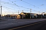
Preston Station Entrance

Preston railway station is located on the Mernda line in Victoria, Australia. It serves the northern Melbourne suburb of Preston, and it opened on 8 October 1889 as Preston-Murray Road. It was renamed Murray on 1 August 1905, and renamed Preston on 1 December 1909.

Excerpt from the Wikipedia article Preston railway station, Melbourne (License: CC BY-SA 3.0, Authors, Images).

Preston railway station, Melbourne
St Georges Road, Melbourne Preston

Geographical coordinates (GPS) Address Website External links Nearby Places
placeShow on map

Wikipedia: Preston railway station, MelbourneContinue reading on Wikipedia

Geographical coordinates (GPS)

Latitude Longitude
N -37.7387 ° E 145.0006 °
placeShow on map

Address

Preston

St Georges Road
3072 Melbourne, Preston
Victoria, Australia
mapOpen on Google Maps

Website
ptv.vic.gov.au

linkVisit website

linkWikiData (Q7242035)
linkOpenStreetMap (944193062)

Preston Station Entrance
Share experience

Nearby Places

Northcote Koori Mural

The Northcote Koori Mural is located in St Georges Road Thornbury, Victoria in the City of Darebin. It was designed by former Northcote High School art teacher Megan Evans in collaboration with members of the Thornbury-based Aborigines Advancement League, which owns the mural. Evans worked with Aboriginal artist and elder Lin Onus researching and designing the mural in collaboration with members of the Victorian Aboriginal Community, and it was painted in between 1983 and 1985, by trainee artists including Les Griggs, a Gunditjmara man (1962–93), Ray Thomas, Millie Yarran, Ian Johnson and Elaine Trott and many other volunteers. The Northcote Koori Mural was originally located opposite the Northcote Town Hall on Council land in High Street. this site was later sold and the mural was moved to the Aboriginal Advancement League in St. Georges Road, Thornbury where a large, free-standing wall was erected specifically to accommodate the mural on the edge of the Sir Douglas Nicholls Sporting Complex. Megan Evans considered the artwork significant because “…it was a landmark for the Aboriginal community at that time and because Northcote Council was prepared to support a project which was politically ahead of its time".In the late 1990s, the local council sold the land where the mural was situated and it was relocated to nearby St George's Road, Thornbury, close to the AAL's current location.The mural was proposed for inclusion on the Darebin Heritage Overlay in 2011. The Mural represents Victoria's Aboriginal culture and history and contains strong political statements about the incarceration of Aboriginal people Among other elements, it depicts large-scale renderings of historical artworks by Tommy McRae and William Barak, a representation of Aboriginal men manacled in neck chains taken from a well known photograph, and the Lake Tyers land rights campaign of the 1970s.Darebin Council allocated $10,000 in its 2011-12 budget for a report on how to restore the artwork and then a further $80,000 in the 2012-13 budget for the mural's conservation and restoration, after it had become dilapidated from weather and an occasional target of graffiti vandals.The original painted panels were removed, and a restored digital print copy was installed in December 2013.

Division of Batman
Division of Batman

The Division of Batman was an Australian Electoral Division in the state of Victoria. It took its name from John Batman, one of the founders of the city of Melbourne. The division was created in 1906, replacing the Division of Northern Melbourne, and was abolished in 2019 and replaced by the Division of Cooper.The division was located in Melbourne's northern suburbs. It covered an area of approximately 66 square kilometres (25 sq mi) from Thomastown/Bundoora in the north to Clifton Hill in the south, with Merri Creek providing the vast majority of the western boundary and Darebin Creek, parts of Macleod and Plenty Road in Bundoora providing the eastern boundary. The suburbs of Alphington, Clifton Hill, Fairfield, Kingsbury, Northcote, Preston, Reservoir, and Thornbury; and parts of Bundoora, Coburg North, Macleod, and Thomastown were in this division.Held by Labor for all but 10 years of its history, Batman has traditionally been a safe Labor seat. However, the Greens have made the seat a contest since 2010, where they reduced Labor from a 26.0% margin to a 7.9% margin. Though Labor increased their margin against the Greens to 10.6% in 2013, the Greens reduced Labor's margin to just 1.0% in 2016. At the 2018 Batman by-election however, Labor increased their margin to 4.4% against the Greens.In June 2018, the Australian Electoral Commission announced that, at the 2019 Australian federal election, the division would be re-named Cooper, after Aboriginal community leader and activist William Cooper.