Semer, Suffolk
Babergh DistrictCivil parishes in SuffolkOpenDomesdayVillages in Suffolk

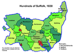
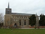
Semer is a small village and civil parish in Suffolk, England. Located adjacent to a bridge over the River Brett on the B1115 between Hadleigh and Stowmarket, it is part of Babergh district. The parish also contains the hamlets of Ash Street and Drakestone Green. The parish was recorded in the 2011 census as having a population of 130, down from 158 in the previous census.
Excerpt from the Wikipedia article Semer, Suffolk (License: CC BY-SA 3.0, Authors, Images).Semer, Suffolk
Babergh
Geographical coordinates (GPS) Address Nearby Places Show on map
Geographical coordinates (GPS)
| Latitude | Longitude |
|---|---|
| N 52.081 ° | E 0.918 ° |
Address
IP7 6JB Babergh
England, United Kingdom
Open on Google Maps


