Ruigoord
Legalized squatsNeighbourhoods of AmsterdamPopulated places in North HollandSquats in the Netherlands

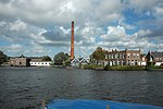
Ruigoord (Dutch pronunciation: [ˈrœyxoːrt]) is a village in the Houtrakpolder in the Dutch province of North Holland, situated within the municipality of Amsterdam. Until the 1880s, it was an island in the IJ bay, which was turned into a polder. In the 1960s, the municipality planned to extend the Port of Amsterdam. From 1972 onwards squatters occupied buildings and started a free zone. After resisting eviction in 1997, the area was legalized in 2000. The village is nowadays partially closed in by the port, and lies about 8 km east of Haarlem.
Excerpt from the Wikipedia article Ruigoord (License: CC BY-SA 3.0, Authors, Images).Ruigoord
Ruigoord, Amsterdam Westpoort
Geographical coordinates (GPS) Address Nearby Places Show on map
Geographical coordinates (GPS)
| Latitude | Longitude |
|---|---|
| N 52.4095 ° | E 4.749 ° |
Address
Ruigoord
Ruigoord
1047 HH Amsterdam, Westpoort
North Holland, Netherlands
Open on Google Maps


