Lordship Lane, Southwark
DulwichStreets in the London Borough of SouthwarkUse British English from January 2018

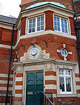
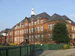
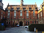
Lordship Lane is an ancient thoroughfare, once rural, in East Dulwich, a suburb of the London Borough of Southwark in southeast London, England, and forms part of the A2216. It runs north–south from Goose Green to Wood Vale. The Lordship Lane & North Cross Road area now has a wide selection of bars, restaurants and specialist retailers for the 'foodie' market.
Excerpt from the Wikipedia article Lordship Lane, Southwark (License: CC BY-SA 3.0, Authors, Images).Lordship Lane, Southwark
Lordship Lane, London East Dulwich (London Borough of Southwark)
Geographical coordinates (GPS) Address Nearby Places Show on map
Geographical coordinates (GPS)
| Latitude | Longitude |
|---|---|
| N 51.4515 ° | E -0.0765 ° |
Address
Crystal Palace Road
Lordship Lane
SE22 8JF London, East Dulwich (London Borough of Southwark)
England, United Kingdom
Open on Google Maps


