Al-Mujaydil
Arab villages depopulated during the 1948 Arab–Israeli WarDistrict of NazarethPages with non-numeric formatnum arguments

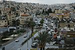
Al-Mujaydil (Arabic: المْجيدل (also: al-Mujeidil) was an Arab-Palestinian village located 6 km southwest of Nazareth. Al-Mujaydil was one of a few towns that achieved local council status by the Mandatory Palestine government. In 1945, the village had a population of 1,900 and total land area of 18,836 dunams – mostly Arab-owned. The population was partly Christian and the town contained a Roman Catholic church and monastery. After the 1948 depopulation of Palestine, it was destroyed and overbuilt by Migdal HaEmek.
Excerpt from the Wikipedia article Al-Mujaydil (License: CC BY-SA 3.0, Authors, Images).Al-Mujaydil
HaGai, Migdal Haemeq
Geographical coordinates (GPS) Address Nearby Places Show on map
Geographical coordinates (GPS)
| Latitude | Longitude |
|---|---|
| N 32.678333333333 ° | E 35.244166666667 ° |
Address
פארק העתיקות
HaGai
2304923 Migdal Haemeq
North District, Israel
Open on Google Maps


