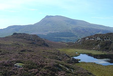
Moel Siabod
Capel CurigDolwyddelanHewitts of WalesMarilyns of WalesMountains and hills of Conwy County Borough ... and 2 more
Mountains and hills of SnowdoniaNuttalls

Moel Siabod (Welsh for "bare hill" with unknown meaning of 'Siabod'), is a mountain in Snowdonia, Wales, which sits isolated above the village of Dolwyddelan. At 872 metres (2,861 ft), it is the highest peak in the Moelwynion mountain range. The UK National Mountain Centre, Plas-y-Brenin, is located at the foot of Moel Siabod. From the top of the mountain, it is reputedly possible to see 13 of the 14 highest peaks in Wales on a clear day without turning one's head.
Excerpt from the Wikipedia article Moel Siabod (License: CC BY-SA 3.0, Authors, Images).Moel Siabod
Daear Ddu,
Geographical coordinates (GPS) Address Nearby Places Show on map
Geographical coordinates (GPS)
| Latitude | Longitude |
|---|---|
| N 53.073075 ° | E -3.932464 ° |
Address
Daear Ddu
Daear Ddu
LL24 0ES , Capel Curig
Wales, United Kingdom
Open on Google Maps


