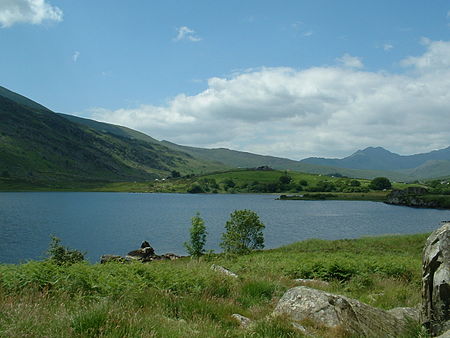
Llynnau Mymbyr

Llynnau Mymbyr are two lakes located in Dyffryn Mymbyr, a valley running from the village of Capel Curig to the Pen-y-Gwryd hotel in Snowdonia, north-west Wales. The A4086 runs along their northern banks. Strictly speaking this is one lake, originally called Llyn Mymbyr, with a maximum depth of 30 feet. About 3/4 mile long in total, a delta has built up midway along the north shore, and this has to all purposes cut the lake in two - hence the plural name. The river feeding the lakes is the Nantygwryd (or Nant-y-gwryd), which has its source at Llyn Cwm-y-ffynnon, also marked on maps as the Nant Gwryd, which is a tributary of the Afon Llugwy. The two rivers join at Capel Curig. The lake was used for fly-fishing and sub-aqua courses in the 1960s and is still used today as a canoe training resource by Plas y Brenin and other local education authorities.
Excerpt from the Wikipedia article Llynnau Mymbyr (License: CC BY-SA 3.0, Authors, Images).Llynnau Mymbyr
A4086,
Geographical coordinates (GPS) Address Nearby Places Show on map
Geographical coordinates (GPS)
| Latitude | Longitude |
|---|---|
| N 53.098055555556 ° | E -3.9297222222222 ° |
Address
A4086
LL24 0ES , Capel Curig
Wales, United Kingdom
Open on Google Maps


