place

Gallt yr Ogof

Capel CurigGwynedd geography stubsHewitts of WalesMountains and hills of Conwy County BoroughMountains and hills of Snowdonia
Nuttalls
Ogi77
Ogi77

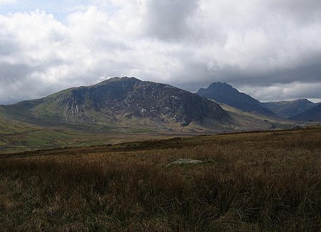
Gallt yr Ogof is a mountain in Snowdonia, North Wales. It is a subsidiary top of Glyder Fawr, and is the most easterly point in the Glyderau mountain range, not including the hill Cefn y Capel. Gallt yr Ogof is 763 metres high.It is a sister peak to Y Foel Goch, which is located on the ridge heading west to Glyder Fach. As its name suggests there is a cave to be found on the cliffs on the precipitous eastern side of the peak.

Excerpt from the Wikipedia article Gallt yr Ogof (License: CC BY-SA 3.0, Authors, Images).

Geographical coordinates (GPS)

Latitude Longitude
N 53.1073 ° E -3.9629 °
placeShow on map

Address

Gwern Gôf Isaf


LL24 0EU , Capel Curig
Wales, United Kingdom
mapOpen on Google Maps

Ogi77
Ogi77
Share experience

Nearby Places

Llyn Ogwen
Llyn Ogwen

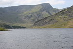
Llyn Ogwen (; Welsh: [ˈɬɪn ˈɔɡʊɛn]) is a ribbon lake in north-west Wales. It lies alongside the A5 road between two mountain ranges of Snowdonia, the Carneddau and the Glyderau. Somewhat unusually, the county boundary at this point is drawn so that the lake itself lies in the county of Gwynedd, but all the surrounding land (excluding the outflow) lies in Conwy County Borough. Llyn Ogwen lies at a height of about 310 metres above sea level and has an area of 78 acres (320,000 m2), but is a very shallow lake, with a maximum depth of only a little over 3 metres. It is fed by a number of streams from the slopes of the mountains which surround it, which include Tryfan and Pen yr Ole Wen. The largest of these streams is Afon Lloer, which flows from Ffynnon Lloer. It is said that after the Battle of Camlann (King Arthur's final battle), Sir Bedivere (Bedwyr) cast the sword Excalibur into Llyn Ogwen, where it was caught by the Lady of the Lake. Tryfan is said to be Sir Bedivere's final resting-place. According to the writer Jonah Jones:"J. M. Archer Thomson, a headmaster of Llandudno School and a pioneer rock climber in Snowdonia quotes a strange legend from a Welsh magazine concerning Llyn Ogwen. A Shepherd happened upon a cave in Craig Cwrwgl above the lake containing the treasure of King Arthur. In the midst of the commotion caused by this intrusion, he turned to the lake, and 'behold thereon a coracle in which sat three women of more than mortal beauty, but the dread aspect of the rower would have filled the stoutest heart with terror.' E. W. Steeple, who recorded this legend, suggests it 'seems a little obscure, and it may be that it has become involved with another story', probably that of Llyn Llydaw." Llyn Ogwen is the source of the Afon Ogwen which flows north to reach the sea near Bangor. A dam was built in the Afon Ogwen at Ogwen Bank, in the early 20th century, to raise the level of the river in order to provide water for the use in the nearby Penrhyn Quarry. The lake is popular with anglers and is said to contain excellent trout.

Cantref Arfon
Cantref Arfon

The mediaeval Welsh cantref of Arfon in north-west Wales was the core of the Kingdom of Gwynedd. Later it was included in the new county of Caernarfonshire, together with Llŷn and Arllechwedd under the terms of the Statute of Rhuddlan in 1284. The island of Anglesey faced it across the Menai Strait; to the east was the cantref of Arllechwedd, to the south the cantref of Eifionydd (which, together with Ardudwy, was part of the earlier kingdom of Dunoding), and to the west was the cantref of Llŷn. As the name suggests, Arfon faces Anglesey (Môn) (see soft mutation) across the Menai, and controls access to that strategic strait which has played an important part in Welsh history. Broadly speaking, it stretched from the peaks of Yr Eifl in the west to Afon Cegin, a stream just east of Bangor, and inland from the shores of the Menai southwards into the heart of Snowdonia (Eryri), including Dyffryn Nantlle and the strategic Llanberis Pass. In geographical terms, the cantref was very variable, including fertile land and rich pastures on the shore of the Menai and in the valleys, a number of woods on the slopes and mountains to the south, and the highest mountains in Wales such as Snowdon and Tryfan. Arfon comprised two commotes, which were apparently created later in its history: Arfon Is Gwyrfai and Arfon Uwch Gwyrfai, whose boundary was the Gwyrfai River. During the Iron Age and the Roman era, it was part of the territory of the Ordovices. The Roman fort of Segontium and the Dinorwig hill fort were located there. The main defensive fortress in the era of the Welsh princes was Dolbadarn Castle, near modern Llanberis. Important ecclesiastical centres were to be found in Bangor and Clynnog Fawr. The bishops of Bangor, the successors of St Deiniol, had an extensive holding of land in the north-east of the cantref. This was known as Maenol Bangor, but its status as an administrative unit within Arfon is uncertain. Clynnog owned broad lands in Llŷn and Anglesey. Arfon features prominently in Welsh mythology, particularly in the Fourth Branch of the Mabinogi. Math fab Mathonwy's court at Caer Dathyl was located there, as was Aranrhod's at Caer Aranrhod. The battle between the forces of Math and Pryderi took place in Arfon. Lleu Llaw Gyffes flies to Nantlleu in Arfon in the form of an eagle after his attempted murder by Gronw Pebr.A local government district of the same name existed from 1974 to 1996, when Gwynedd became a unitary authority. The name Arfon itself is still used for the area, as it has been for centuries in Wales.