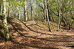
Oldbury rock shelters
19th-century archaeological discoveriesArchaeological sites in KentMousterianRock sheltersTonbridge and Malling

The Oldbury rock shelters are a complex of Middle Palaeolithic sites situated on the slopes of Oldbury hillfort near Ightham in the English county of Kent.They were occupied by Mousterian flint tool manufacturers around 50,000 years ago and examples of their characteristic bout-coupé handaxes were found there during excavations in the nineteenth and twentieth centuries. The site is open to the public and owned by the National Trust.
Excerpt from the Wikipedia article Oldbury rock shelters (License: CC BY-SA 3.0, Authors, Images).Oldbury rock shelters
Treacle's Climb, Tonbridge and Malling Ightham
Geographical coordinates (GPS) Address Nearby Places Show on map
Geographical coordinates (GPS)
| Latitude | Longitude |
|---|---|
| N 51.286055555556 ° | E 0.26933333333333 ° |
Address
Treacle's Climb
Treacle's Climb
TN15 9DP Tonbridge and Malling, Ightham
England, United Kingdom
Open on Google Maps


