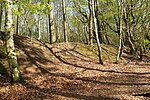
Seal Chart
Kent geography stubsSevenoaks DistrictVillages in Kent
Seal Chart is a village 2 miles (3 km) east of Sevenoaks in Kent, England. It is within the Sevenoaks local government district. It is in the civil parish of Seal.
Excerpt from the Wikipedia article Seal Chart (License: CC BY-SA 3.0, Authors).Seal Chart
Geographical coordinates (GPS) Address Nearby Places Show on map
Geographical coordinates (GPS)
| Latitude | Longitude |
|---|---|
| N 51.28451 ° | E 0.25626 ° |
Address
TN15 0ES , Seal
England, United Kingdom
Open on Google Maps


