place

Albion Viaduct

1929 establishments in AustraliaAustralian bridge (structure) stubsBridges completed in 1929Bridges in MelbourneBuildings and structures in the City of Brimbank
Buildings and structures in the City of Moonee ValleyHeritage-listed buildings in MelbourneMaribyrnong RiverRailway bridges in Victoria (Australia)Transport in the City of BrimbankTransport in the City of Moonee ValleyUse Australian English from August 2019Victoria (Australia) building and structure stubs
Maribyrnong River Viaduct

The Maribyrnong River Viaduct (also known locally as the Quarter Mile Bridge) carries the Albion–Jacana railway line, Melbourne across the Maribyrnong River in the western suburbs of Melbourne, Australia. It is located near the E J Whitten Bridge, and is almost 400 metres long (hence the Quarter Mile name). It was built in 1927–29 by the Victorian Railways Construction Branch, being the largest trestle bridge in Australia when completed in June, 1929. Until the completion of the Sydney Harbour Bridge, the viaduct was also the highest railway bridge in Australia. It employed 200 people during its construction, with one fatality, and is listed on the Victorian Heritage Register.With a length of 383 m (1,257 ft), and a height of 55 m (180 ft) above the water level, it is the second-highest bridge in Victoria after the West Gate Bridge (58 metres) The main traffic over the bridge is freight services, but it also carries two passenger services, the Melbourne to Sydney NSW TrainLink XPT, and the Melbourne-Albury V/Line service which now runs on standard gauge.

Excerpt from the Wikipedia article Albion Viaduct (License: CC BY-SA 3.0, Authors, Images).

Albion Viaduct
Maribyrnong River Trail, Melbourne Keilor East

Geographical coordinates (GPS) Address Nearby Places
placeShow on map

Wikipedia: Albion ViaductContinue reading on Wikipedia

Geographical coordinates (GPS)

Latitude Longitude
N -37.748055555556 ° E 144.8455 °
placeShow on map

Address

Maribyrnong River Trail

Maribyrnong River Trail
3034 Melbourne, Keilor East
Victoria, Australia
mapOpen on Google Maps

Maribyrnong River Viaduct
Share experience

Nearby Places

Knights Stadium (Melbourne)

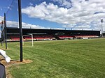
Knights Stadium is an Australian soccer stadium in Sunshine North, a suburb of Melbourne, Victoria. Built in 1989, it is used by the Melbourne Knights as a home ground in the NPL Victoria competition, and previously in the National Soccer League (NSL). The Knights were one of only a handful of clubs in the NSL to actually own their home ground.The land at Somers Street, which had been a Village drive through cinema, was bought and developed largely through donations and volunteer work from the local Croatian community. The idea was that if 1000 people each donated $300 that would equal $300,000, more than enough to purchase the land. The stadium holds approximately 15,000 people. It consists of a seated main stand (the Mark Viduka Stand) which has a capacity of 4,000 and open standing-room terracing around the rest of the stadium. The largest crowd at the stadium came in 2000 at a National Soccer League match between the Melbourne Knights and South Melbourne, it drew a crowd of 11,500. The Stadium complex covers around 12.5 acres (51,000 m2). It has three pitches, including the main pitch. The complex also contains the Melbourne Croatia club rooms and the Knights Sports Gym (an open to the public member's boxing / fitness gymnasium under the stadium). The facility has two car parks with 700 spaces. The stadium is also home to the Melbourne Croatia Soccer Club, which currently owns the stadium with the Melbourne Knights serving as tenants. This came about in 2006 when the Melbourne Knights and Melbourne Croatia Soccer Club Inc. separated and become two separate legal entities. The beginning of 2008 saw Knights Stadium facilities receive its most significant face-lift since the grandstand was first built with the main pitch being re-laid, as well as renovations on both the grandstand and terraces. In the 2009 season the stadium's name was changed from Knights Stadium to Mansion Stadium, after online betting giant Mansion88, became the club's major sponsor and bought the naming rights to the stadium. This was a temporary naming deal for the 2009 season. Their sponsorship deal has since ended and the name then returned to that of Knights Stadium. In 2011, the club replaced 900 old and broken seats in order to host the first round of the 2011 Australasian Supercross Championships. In 2016, Knights spent around $100,000 on Stadium upgrades, including further asphalting of the car-park and a replacement of the old, tall fence, with a smaller, more viewer-friendly, fence, bringing it in line with most other premium stadiums around the State.

Avondale Heights, Victoria

Avondale Heights is a suburb in Melbourne, Victoria, Australia, 11 km (6.8 mi) north-west of Melbourne's Central Business District, located within the City of Moonee Valley local government area. Avondale Heights recorded a population of 12,388 at the 2021 census.Avondale Heights is located on a plateau bounded by a large bend of the Maribyrnong River to the east, south, and west, and to the north by Buckley Street. The suburb derives its name from the Avondale Estate. Originally known as Maribyrnong West, when the Council undertook to change the name, postal authorities drew attention to the existence of Avondale in Queensland. The suburb was therefore called Avondale Heights to distinguish it from the Queensland town. Walter Burley Griffin and Marion Mahony Griffin prepared plans for part of the area: Milleara Estate in the north (also known as City View) in the 1920s. One objective of their design was to remake suburbia and society. They did this through creating internal gardens where communities could both physical and socially bind together. They imagined children's playgrounds, social centres, nature reserves and links with an intricate system of pedestrian ways. Interviewed in Melbourne in 1913, Griffin spoke of internal reserves as: ...favourite playgrounds. Here all the children from the different houses can play together, where their mothers can see them, and where they are safe from the motor traffic in the streets. The streets are designed in a curvilinear way typical of Griffin's design, often following the topography of the land. There is only one main road – Military Road which runs from Canning Street and Maribyrnong Road, then becoming Milleara Road at the Avondale Heights Police Station. There are about 40 shops at the Canning Street end (including Raglan Street) and 20 at the other end, near the St Martin De Porres Primary School.