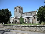
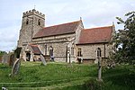
Thorpe Mandeville
Civil parishes in NorthamptonshireUse British English from March 2014Villages in NorthamptonshireWest Northamptonshire District

Thorpe Mandeville is a village and civil parish in West Northamptonshire, England about 6 miles (10 km) northeast of Banbury in neighbouring Oxfordshire. The hamlet of Lower Thorpe is just north of the village. The village's name means 'Outlying farm/settlement'. The village was held by Richard de Amundevill in 1252.The population of the parish has grown slowly over the centuries. It was recorded as 137 in the 1801 Census, 178 in the 1991 Census, 194 in the 2001 Census and 327 (including Edgcote) in the 2011 Census.
Excerpt from the Wikipedia article Thorpe Mandeville (License: CC BY-SA 3.0, Authors, Images).Thorpe Mandeville
Banbury Lane,
Geographical coordinates (GPS) Address Nearby Places Show on map
Geographical coordinates (GPS)
| Latitude | Longitude |
|---|---|
| N 52.1 ° | E -1.224 ° |
Address
Banbury Lane
Banbury Lane
OX17 2EZ
England, United Kingdom
Open on Google Maps


