place

WWT Slimbridge

Birdwatching sites in EnglandEnvironment of GloucestershireNature centres in EnglandNature reserves in GloucestershireProtected areas established in 1946
Stroud DistrictTourist attractions in GloucestershireUse British English from June 2015Wetlands of EnglandWildfowl & Wetlands Trust centres
Nene Geese in Slimbridge

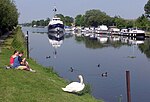
WWT Slimbridge is a wetland wildlife reserve near Slimbridge in Gloucestershire, England. It is midway between Bristol and Gloucester on the eastern side of the estuary of the River Severn. The reserve, set up by the artist and naturalist Sir Peter Scott, opened in November 1946. Scott subsequently founded the Wildfowl & Wetlands Trust, which has since opened nine other reserves around the country. Slimbridge comprises some 800 hectares (2,000 acres) of pasture, reed bed, lagoon and salt marsh. Many water birds live there all year round, and others are migrants on their ways to and from their summer breeding grounds. Other birds overwinter, including large numbers of white-fronted geese and increasing numbers of Bewick's swans. Besides having the world's largest collection of captive wildfowl, Slimbridge takes part in research and is involved in projects and internationally run captive breeding programmes. It was there that Peter Scott developed a method of recognising individual birds through their characteristics, after realising that the coloured patterns on the beaks of Bewick's swans were unique. The public can visit the reserve throughout the year. Besides examining the collections, they can view birds from hides and observatories and take part in educational activities.

Excerpt from the Wikipedia article WWT Slimbridge (License: CC BY-SA 3.0, Authors, Images).

WWT Slimbridge
Summer Walkway,

Geographical coordinates (GPS) Address Nearby Places
placeShow on map

Wikipedia: WWT SlimbridgeContinue reading on Wikipedia

Geographical coordinates (GPS)

Latitude Longitude
N 51.741471 ° E -2.405979 °
placeShow on map

Address

New Decoy Pool

Summer Walkway
GL2 7BT , Slimbridge
England, United Kingdom
mapOpen on Google Maps

Nene Geese in Slimbridge
Share experience

Nearby Places

River Cam, Gloucestershire

The River Cam is a small river in Gloucestershire, England. It flows for 12 miles (20 km) north-westwards from the Cotswold Edge, across the Vale of Berkeley, into the Gloucester and Sharpness Canal.The river rises on the Cotswold escarpment above the village of Uley, and flows through Dursley, Cam and Cambridge to the Gloucester and Sharpness Canal as a feeder to that waterway. Before the canal was opened in 1827, the Cam flowed into the River Severn at Frampton Pill, Frampton on Severn.The lower river was improved for navigation when the canal was built, and became known as the Cambridge Arm with one entrance lock leading to a basin and wharf at Cambridge, the limit of navigation due to mill weirs and low bridges on the Bristol to Gloucester road. The lock was missing and the basin abandoned by 1901. Most of the straightened channel has survived as flood defence improvements and is potentially still navigable, but the entrance is now blocked by a very low bridge at the site of the former lock. It is thought that the legal right to navigation may still be in force, which is potentially relevant for recreational canoeing, kayaking and stand-up paddleboarding users to enjoy unimpeded access. Upstream from the town of Dursley, the river is known as the River Ewelme. A new fish and eel pass and an additional second channel were dug by the Environment Agency just east of Cambridge in 2014. This drew criticism from local people as no money had been spent on flood defences.