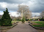
Caledonian Road, London
BarnsburyStreets in the London Borough of IslingtonUse British English from March 2013

Caledonian Road passes for about a mile and a half north–south through the London Borough of Islington. It connects North London, from Camden Road near its junction with Holloway Road, and central London's Pentonville Road in the south. It is known colloquially as the "Cally" and forms the entirety of the A5203.
Excerpt from the Wikipedia article Caledonian Road, London (License: CC BY-SA 3.0, Authors, Images).Caledonian Road, London
Caledonian Road, London Barnsbury (London Borough of Islington)
Geographical coordinates (GPS) Address Nearby Places Show on map
Geographical coordinates (GPS)
| Latitude | Longitude |
|---|---|
| N 51.546 ° | E -0.118 ° |
Address
H M Prison Pentonville
Caledonian Road
N7 9BG London, Barnsbury (London Borough of Islington)
England, United Kingdom
Open on Google Maps


