Union Pond (Massachusetts)
Plymouth County, Massachusetts geography stubsPonds of MassachusettsPonds of Plymouth County, MassachusettsWareham, Massachusetts
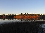
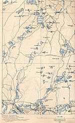
Union Pond is a 25-acre (100,000 m2) pond in Wareham, Massachusetts. The pond is located southeast of Mill Pond. Route 25 runs north of the pond, Routes 6 and 28 runs south of the pond, and Glen Charlie Road runs west of the pond.
Excerpt from the Wikipedia article Union Pond (Massachusetts) (License: CC BY-SA 3.0, Authors).Union Pond (Massachusetts)
Cranberry Highway,
Geographical coordinates (GPS) Address Nearby Places Show on map
Geographical coordinates (GPS)
| Latitude | Longitude |
|---|---|
| N 41.7625 ° | E -70.671111111111 ° |
Address
Cranberry Highway 2870
02571
Massachusetts, United States
Open on Google Maps


